- Date
- Thursday, April 3, 2025
Upcoming warm weather, sun, and rising freezing levels could mean another big avalanche cycle
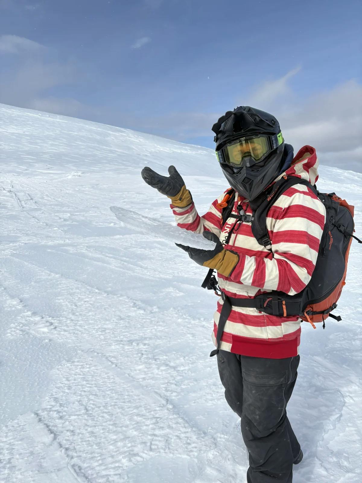
Wet loose avalanches should be expected from steep sun-exposed slopes during periods of intense warming. Credit: Avalanche Canada Yukon Field Team MIN
The transition from a winter to a spring snowpack is often accompanied by growing pains–and this year is no exception. Spring made a dramatic entrance between March 24 and 27, bringing freezing levels above 3000 metres with rain followed by sunny skies. The result was high avalanche danger and a widespread natural avalanche cycle.
Throughout the province, very large avalanches failed on buried weak layers, running far into flat terrain or valley bottom–in some cases, even carving out new avalanche paths by taking down stands of mature timber. Many of these avalanches were triggered by large cornice failures.
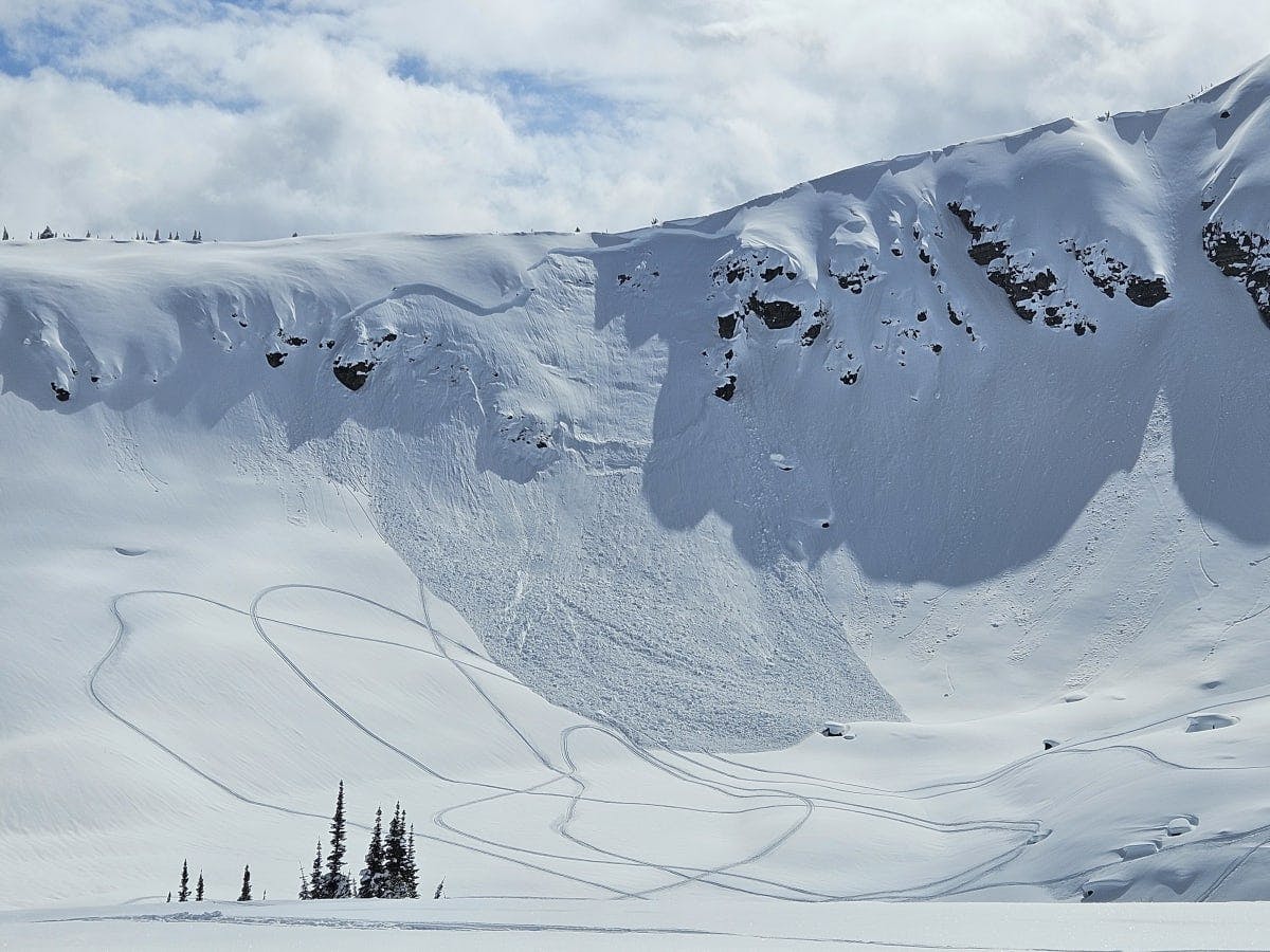
Very large avalanches were common during the last warming event, with wet avalanche debris observed running far into runout zones like this example from the Purcells. Credit: MIN User KOKANEER
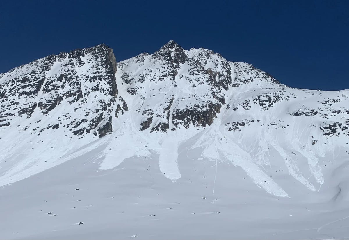
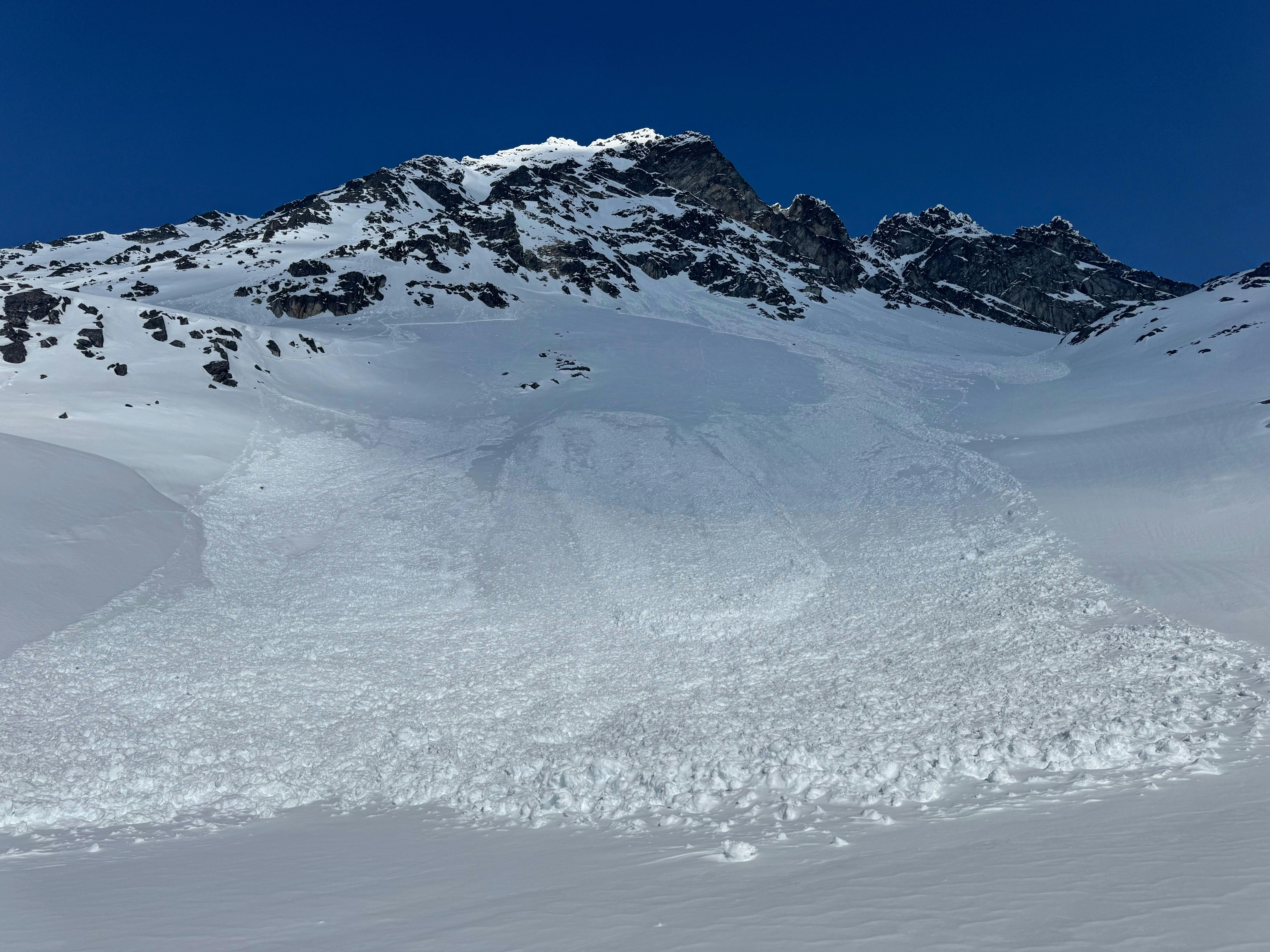
A large natural avalanche during the last warm-up which was probably cornice triggered. Similar avalanches are possible this weekend, especially with cornice falls as a trigger. Credit: MIN User DZSKIZ
A human-triggered slab avalanche in the north Monashees, which was triggered from below. Human-triggered avalanches are expected to remain likely this weekend. Credit: MIN User LOUISGODIN1980
Looking ahead to the weekend and into next week, the forecast is calling for a return of elevated freezing levels and either strong sun or a mix of sun and cloud in most regions. Will this bring a repeat of last week’s avalanche activity? It’s hard to say, as several key factors are at play:
- Although we’re not seeing the heavy precipitation that preceded the last warming period, recent snow in some regions will be sensitive to its first exposure to heat and sun.
- Weak layers in the snowpack persist and have continued to produce sporadic avalanche activity, even during the cooler weather.
- This next heatwave must first break down crusts formed by the last warming and cooling cycle before it can affect deeper buried weak layers. Areas with moist snow below these crusts may see rapid deterioration once the surface crusts break down.
- Generally, subsequent punches of heat have less and less of a dramatic effect as the snowpack becomes accustomed to temperature fluctuations.
A supportive surface crust generally reduces the likelihood of triggering avalanches. With the major warming this weekend, we expect the surface crust to break down in many regions, potentially increasing the likelihood of avalanches. Credit: North Rockies Field Team MIN
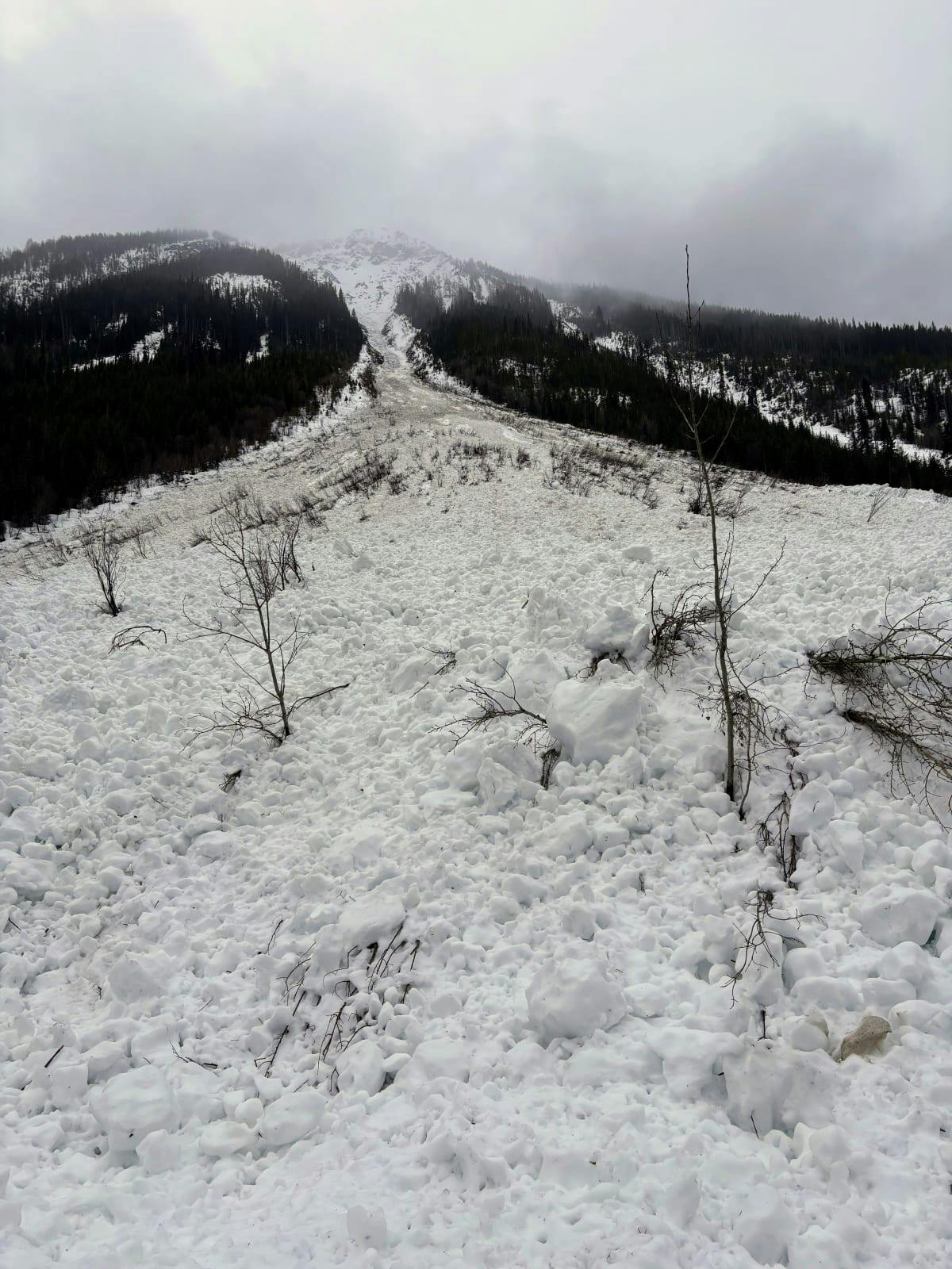
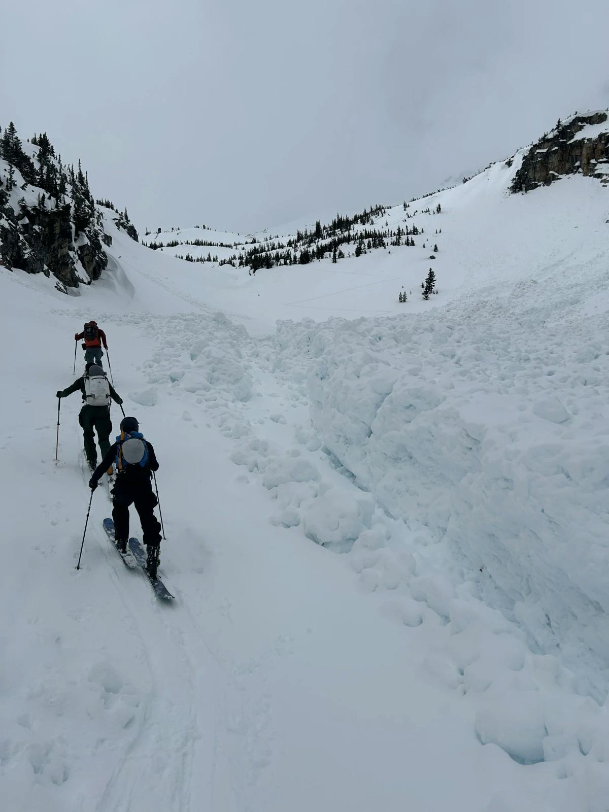
Avalanche runs out into low-angle terrain. Plan your travel with long runouts in mind. Credit: MIN User ADAMRODRIGUES11
So, although the spectacle may not match last week’s dramatic events, the potential for very large, destructive avalanches remains. It’s a time to keep our guard up and factor extra margin into our decision-making.
Key considerations:
- Always check the forecast for your area before heading out–the evening before and the morning of, in case anything has changed.
- Remember that spring conditions are dynamic and can shift rapidly throughout the day.
- Be aware that snowpack and avalanche problems vary significantly with elevation, so assess and evaluate conditions continuously as you travel.
- Travel early through areas exposed to avalanche hazard before the sun and daytime warming break down crusts and weaken cornices.
- Carefully plan your exit routes in terms of exposure to avalanche terrain, keeping in mind the potential for increased avalanche danger by day’s end.
- Avoid runouts of avalanche paths. Avalanches may travel farther than expected. Overhead exposure isn’t always obvious–be aware of what looms high above you.
On a positive note, this is a temporary transitional period. These initial warm ups are what facilitate the structural changes that transition a cold, winter snowpack to a more predictable diurnal melt-freeze spring snowpack regime. Think of this as a short-term sacrifice in favour of long-term stability that will allow us to tee up those big lines safely soon enough!
Watch out for exposure from above when travelling through avalanche terrain. This debris ran well into the runout zone. Credit: MIN User DAVESLADE14
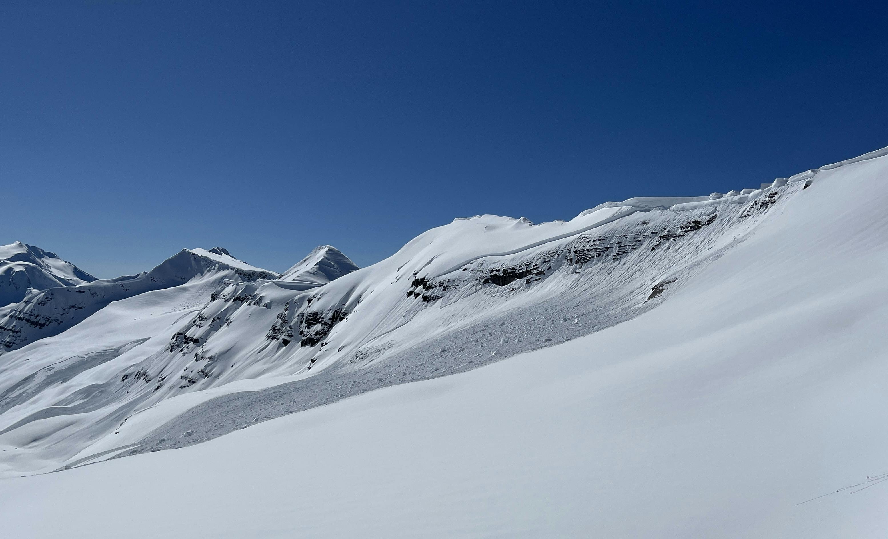
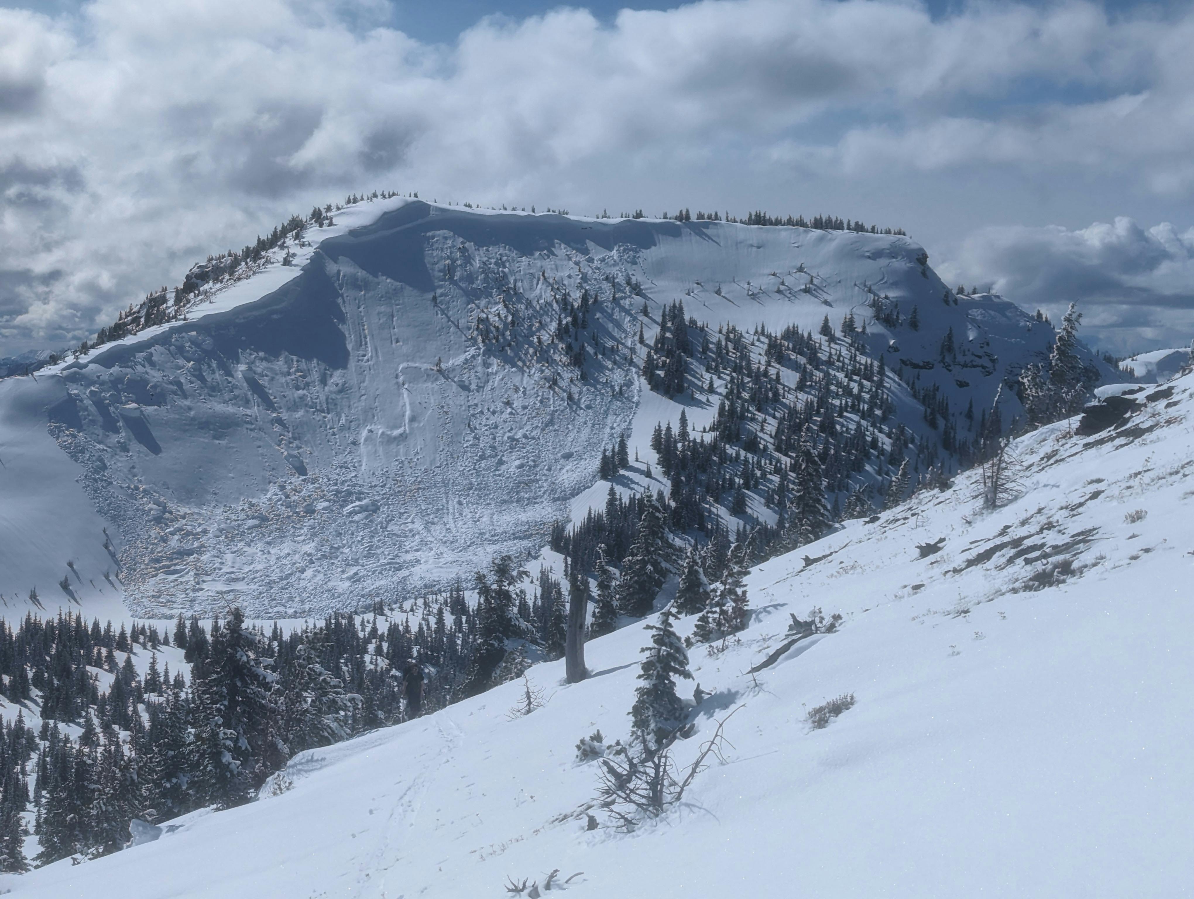
A cornice failure triggered this large slab in the North Rockies, which failed on a weak layer deep in the snowpack near the ground.
A large slab avalanche suspected to have been triggered by solar input. Credit: Avalanche Canada Northwest Field Team MIN.