- Date
- Friday, April 25, 2025
Today marks the final day of forecasting for this winter. As we sign off, conditions appear relatively straightforward across most areas. Repeated periods of strong sunshine and significant warming have effectively tested deeper layers throughout much of the province. The earlier warm-ups caused elevated danger, but in the long term, the warm days with overnight re-freezes have stabilized the snowpack. Most places are looking at fairly stable conditions for any spring adventures, but there are (of course) a few exceptions.
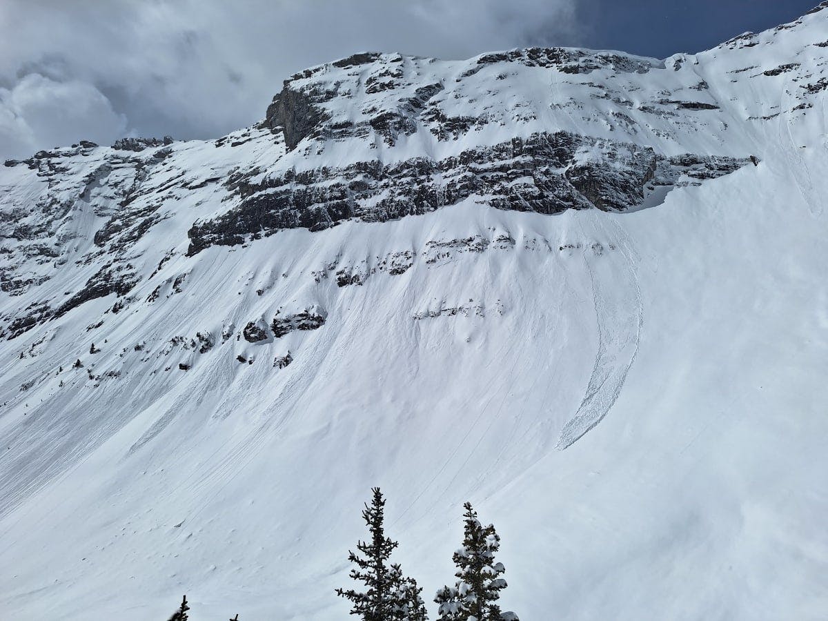
Steep, rocky slopes are common places for wet loose avalanches, especially on warm sunny days. Credit: MIN User tommichaelhay
In shallower snowpack areas in the Rockies and Purcells, the inherently weak basal facets could still be triggered by large cornice falls or by a rider in shallow, steep terrain. This will be especially true when we shift into an “all-melt, no freeze” scenario when the temperatures don’t go below zero at night.
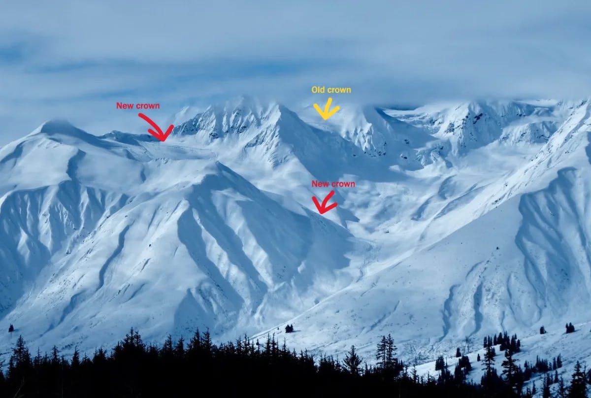
Large persistent slab avalanches can continue well into the spring, like this recent example from Haines Pass. Credit: MIN User jeffmoskowitz
In addition to the shallower snowpack areas, northern BC and the Yukon will also be places to watch. The snowpack here has not seen warming as dramatic as regions to the south, and layers in the mid and lower snowpack have still been producing periodic large, surprising avalanches. It’s likely that when we do get that first big hit of summer-like heat, deeper layers could wake up, and a large avalanche cycle could occur. But those conditions are probably better beach weather anyway!
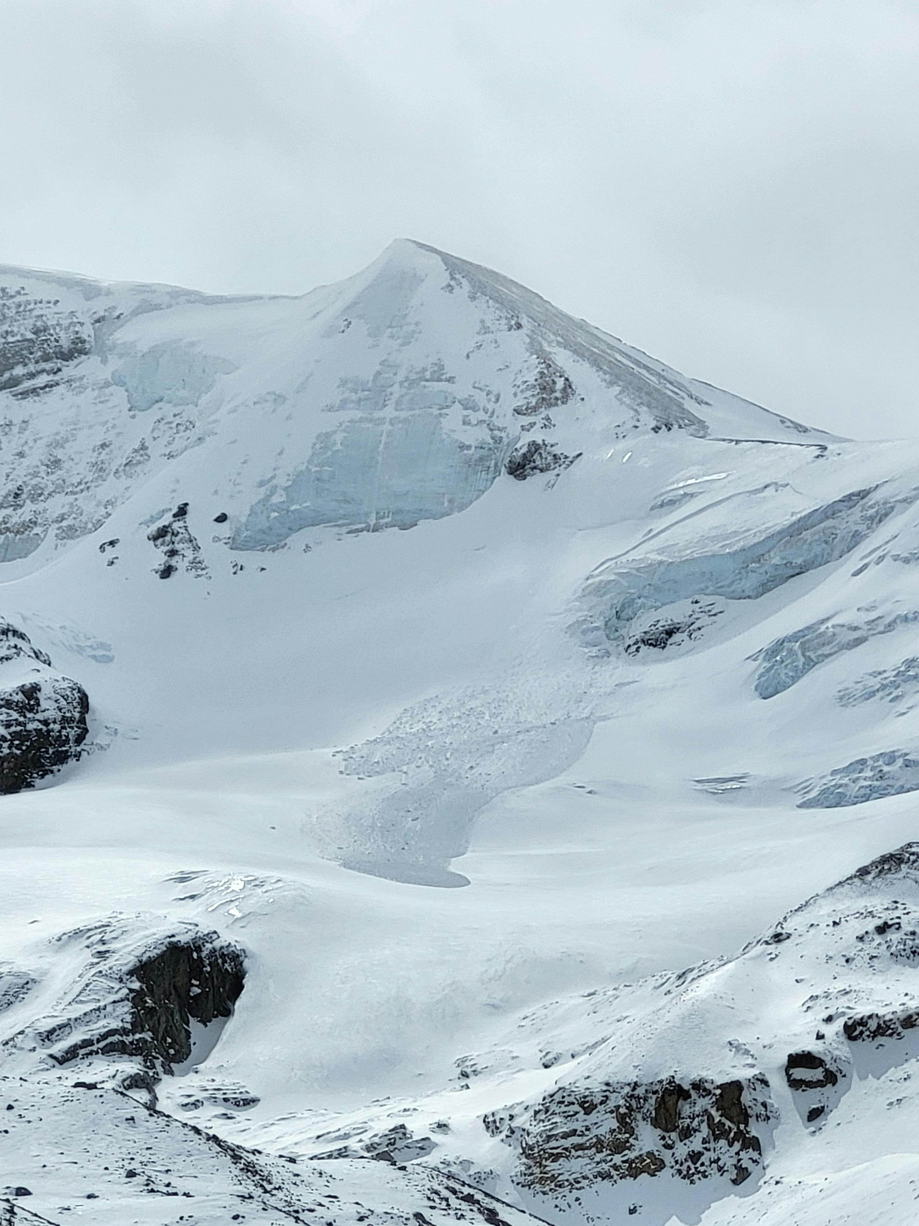
Wind slab avalanches are common in the spring at higher elevations. Credit: MIN User ariseguiding
Next week, we anticipate the return of more active weather in coastal areas. If you’re planning on getting out there, remember that there will be no avalanche forecasts available, so you’ll need to be able to assess the danger on your own.
Otherwise, it’s looking like it will be a pretty typical spring. If you’re ambitious and willing to work (or use jet fuel) to reach higher elevations, skiing on glaciers and higher north-facing terrain could still offer some great riding. Chasing elusive corn skiing on sunny slopes is also a worthwhile endeavour. Here are some general scenarios and things to think about as you are planning your spring missions:
- Cold and Snowy: Winter-like storms can still occur, bringing new snow and wind that can form storm slab or wind slab conditions. These slabs may form over melt-freeze crusts, creating a potential sliding layer. Be cautious during and after storms, especially on leeward slopes where wind loading is prevalent.
- Daily Melt-Freeze Cycles: Clear days and cold nights lead to surface crusts forming overnight, which then soften during the day. This cycle can produce favourable conditions for corn snow, but also increases the risk of loose wet avalanches in the afternoon. Plan travel to avoid steep, sun-exposed slopes during the warmest parts of the day.
- All Melt, No Freeze: Prolonged warm temperatures without overnight refreezing cause a weakening snowpack. This scenario increases the likelihood of wet slab avalanches and deep persistent slab avalanches as meltwater penetrates deeper layers. Limit exposure to avalanche terrain during these periods, and be especially wary of large, unsupported slopes.
- All Freeze, No Melt: Consistently cold temperatures maintain a frozen snowpack, generally reducing avalanche risk. However, isolated instabilities may persist, particularly on high, north-facing slopes. Continue to assess conditions and remain cautious in complex terrain.
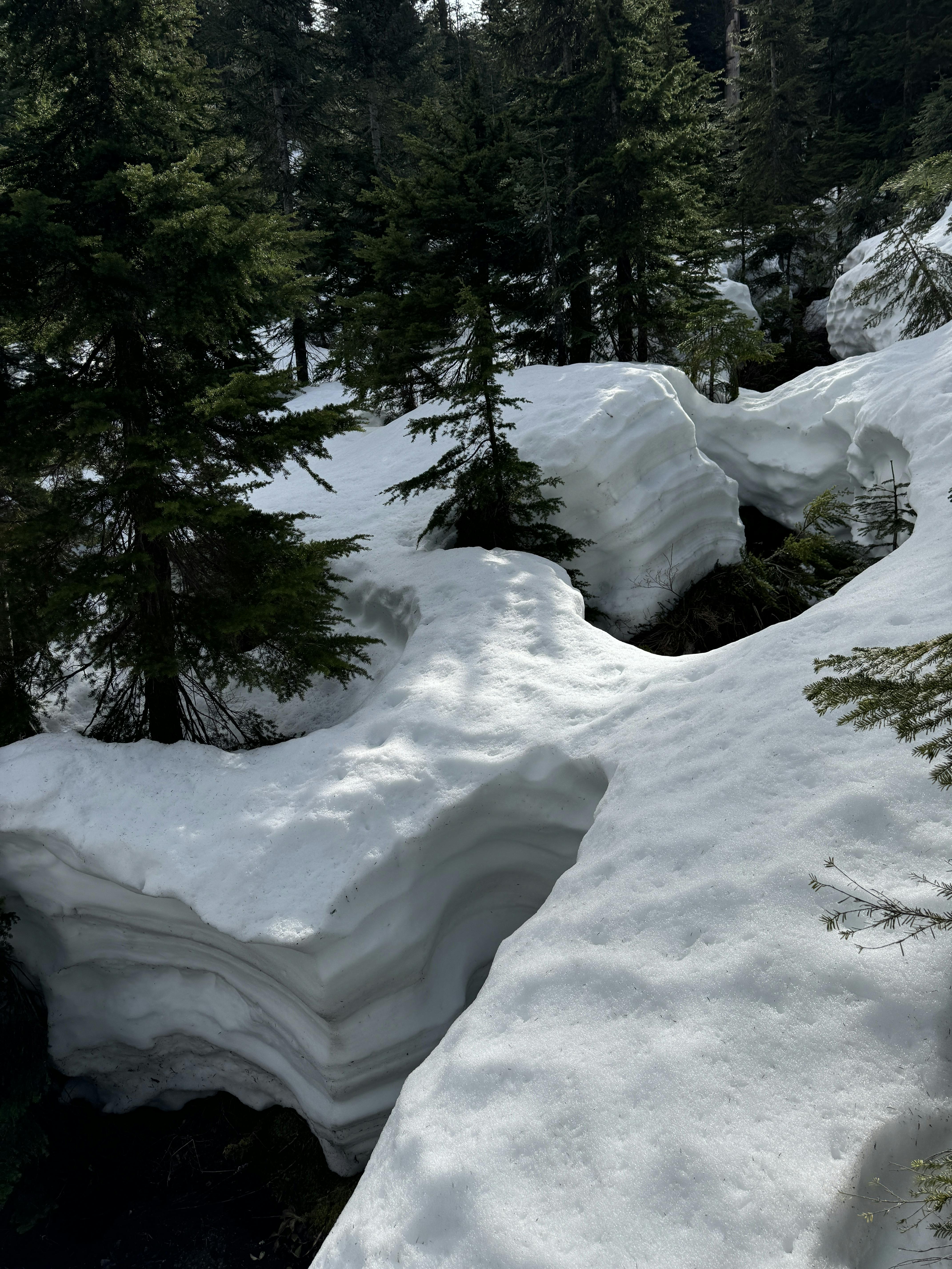
Open creeks can be hazardous in the spring. Credit: MIN User sportnewk
Spring Travel Tips
While it is useful to understand which of the spring scenarios is occurring when you are heading out, it is also important to continually assess conditions as you are travelling. Here are some tips for the spring:
- Timing is Crucial: Start early to take advantage of firm morning conditions and aim to be off avalanche-prone slopes before the day's warmth increases instability.
- Monitor Weather and Conditions: Stay informed about current weather forecasts and check for conditions reports on the MIN. Be prepared to adjust plans based on changing conditions.
- Assess Terrain Carefully: Evaluate slope aspect, elevation, and exposure to sun and wind. South and east-facing slopes typically warm earlier in the day and west-facing slopes later in the day, increasing avalanche risk.
- Watch for Signs of Instability: Recent avalanche activity, cracking, or "whumphing" sounds all indicate unstable conditions. If you observe these signs, reassess your route and consider safer alternatives.
- Cornice Awareness: Cornices become increasingly unstable with warming temperatures. Give them a wide berth, both above and below, to avoid potential collapse. Remember, they can break far back from the ridgeline.
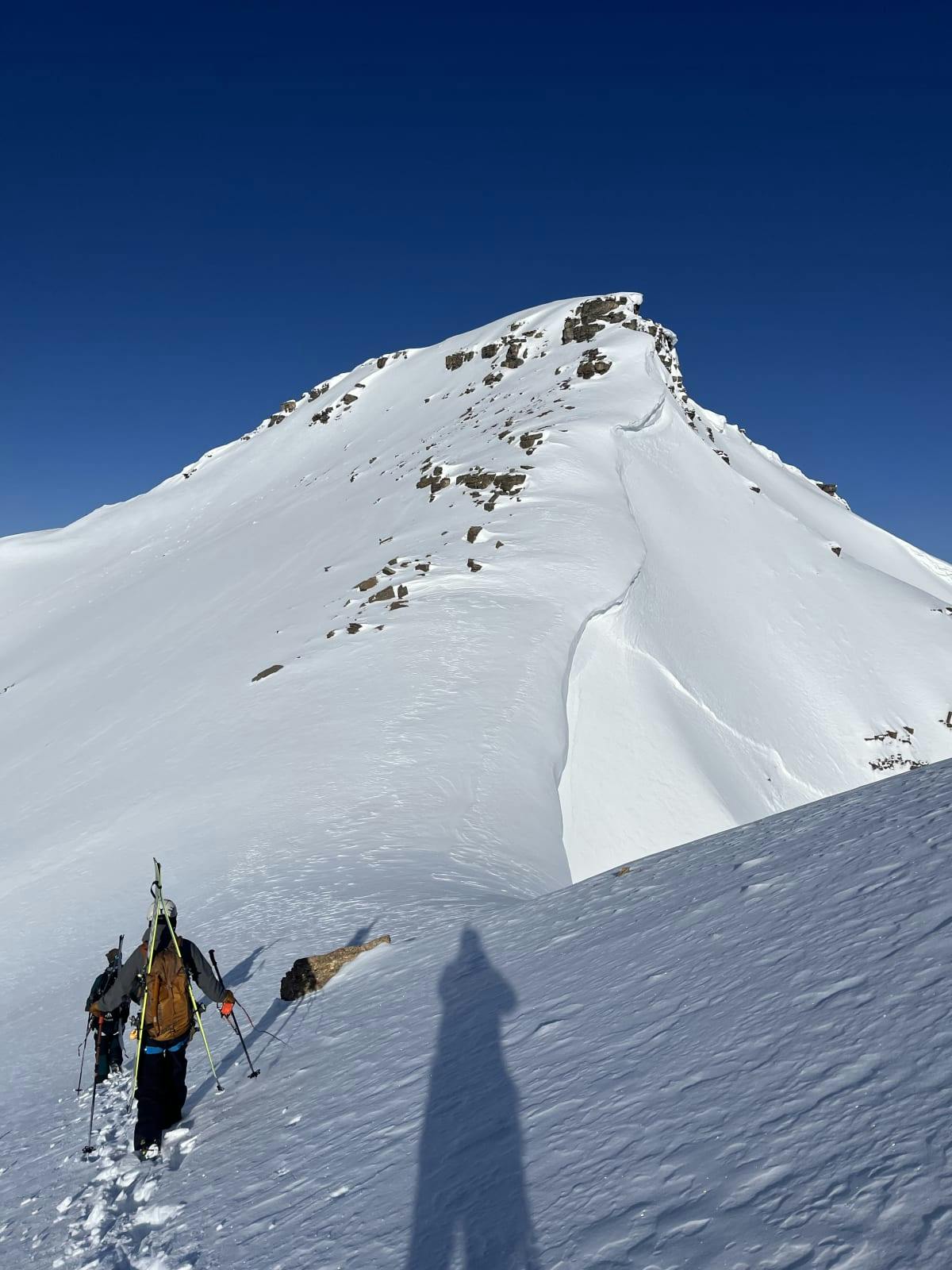
Give cornices a wide berth when travelling on ridges. Credit: MIN User alexcarpentier420