- Submitted by
- ReginaBBQ
- Observations date
- Tuesday, January 6, 2026 at 19:00
- Location
- 50.953384° N 118.282694° W
- Reporting on
- Snow conditions
%2F-118.28269443563221%2C50.953383941280805%2C8%2C0%2C0%2F1026x200%3Faccess_token%3Dpk.eyJ1IjoiYXZhbGFuY2hlY2FuYWRhIiwiYSI6ImNqd2dvZmUxdzE4ZWg0M2tkaXpuNG95aTQifQ.pBLM87fE3sIxRJqJT7Bf7g&w=1200&q=75 "Too deep to handle")
Quick
Avalanche
Snowpack
Weather
Incident
Information
- Avalanche date/time
- Tuesday, January 6, 2026 at 19:00
- Number of avalanches in this report
- 1
- The size of avalanche
- 1
- Slab thickness
- 30cm
- Slab width
- 10m
- Run length
- 10m
- Avalanche Character
- Storm slab
- Trigger type
- Skier
- Trigger subtype
- Accidental
- Start zone aspect
- E
- Start zone elevation band
- Below treeline
- Start zone elevation
- 1,600m
- Start zone incline
- 40°
- Weak layer burial date
- Thursday, January 1, 2026
- Weak layer crystal type
- Surface hoar
- Wind exposure
- No wind exposure
- Vegetation cover
- Sparse trees or gladed slope
Comments
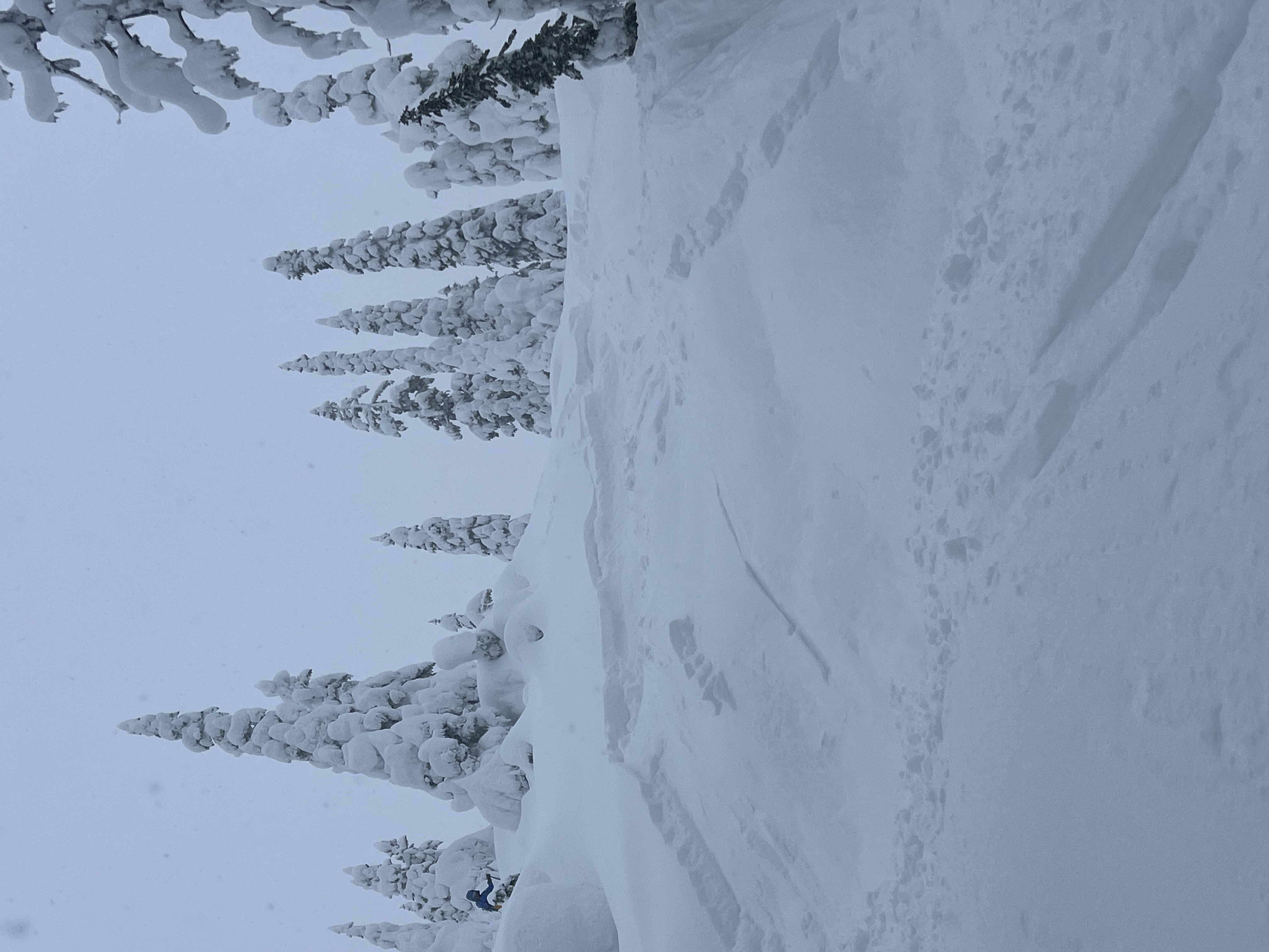
- couple groups heading out towards the knobs on MacPherson
- hand shears broke on buried surface hoar but without a significant slab stiffness
- shooting cracks about 50cm away from ski
- triggered a small avalanche behind a roll on a short steep pitch
- stayed away from bigger steep terrain
- mellow terrain was too deep to be skied nicely