- Submitted by
- ericksonjjacob
- Observations date
- Saturday, February 21, 2026 at 16:30
- Location
- 49.452357° N 117.199660° W
- Reporting on
- Snow conditions
%2F-117.19965962086684%2C49.45235737262996%2C8%2C0%2C0%2F1026x200%3Faccess_token%3Dpk.eyJ1IjoiYXZhbGFuY2hlY2FuYWRhIiwiYSI6ImNqd2dvZmUxdzE4ZWg0M2tkaXpuNG95aTQifQ.pBLM87fE3sIxRJqJT7Bf7g&w=1200&q=75 "Persistent Layer Triggered by Heavy Loading")
Quick
Avalanche
Snowpack
Weather
Incident
Information
- Avalanche date/time
- Saturday, February 21, 2026 at 16:30
- Estimated occurrence time of avalanche
- From 12 to 24 hours ago
- Number of avalanches in this report
- 1
- The size of avalanche
- 2.5
- Slab thickness
- 30cm
- Slab width
- 150m
- Run length
- 200m
- Avalanche Character
- Persistent slab
- Trigger type
- Skier
- Trigger subtype
- Accidental
- Start zone aspect
- NE
- Start zone elevation band
- Treeline
- Start zone elevation
- 1,990m
- Start zone incline
- 40°
- Runout zone elevation
- 1,890m
- Weak layer burial date
- Wednesday, January 28, 2026
- Weak layer crystal type
- Surface hoar
- Crust near weak layer
- Yes
- Wind exposure
- Cross-loaded slope
- Vegetation cover
- Sparse trees or gladed slope
Comments
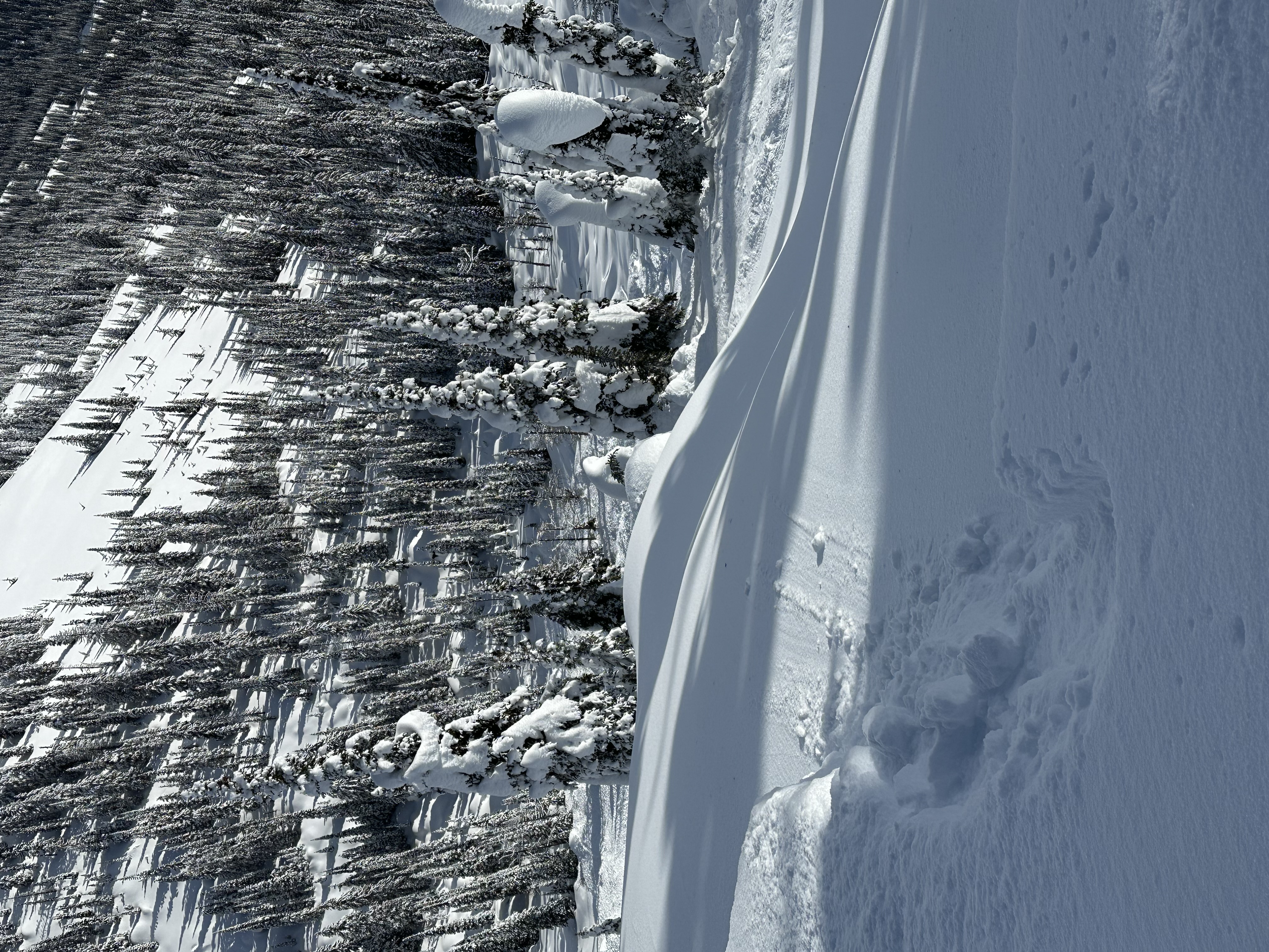
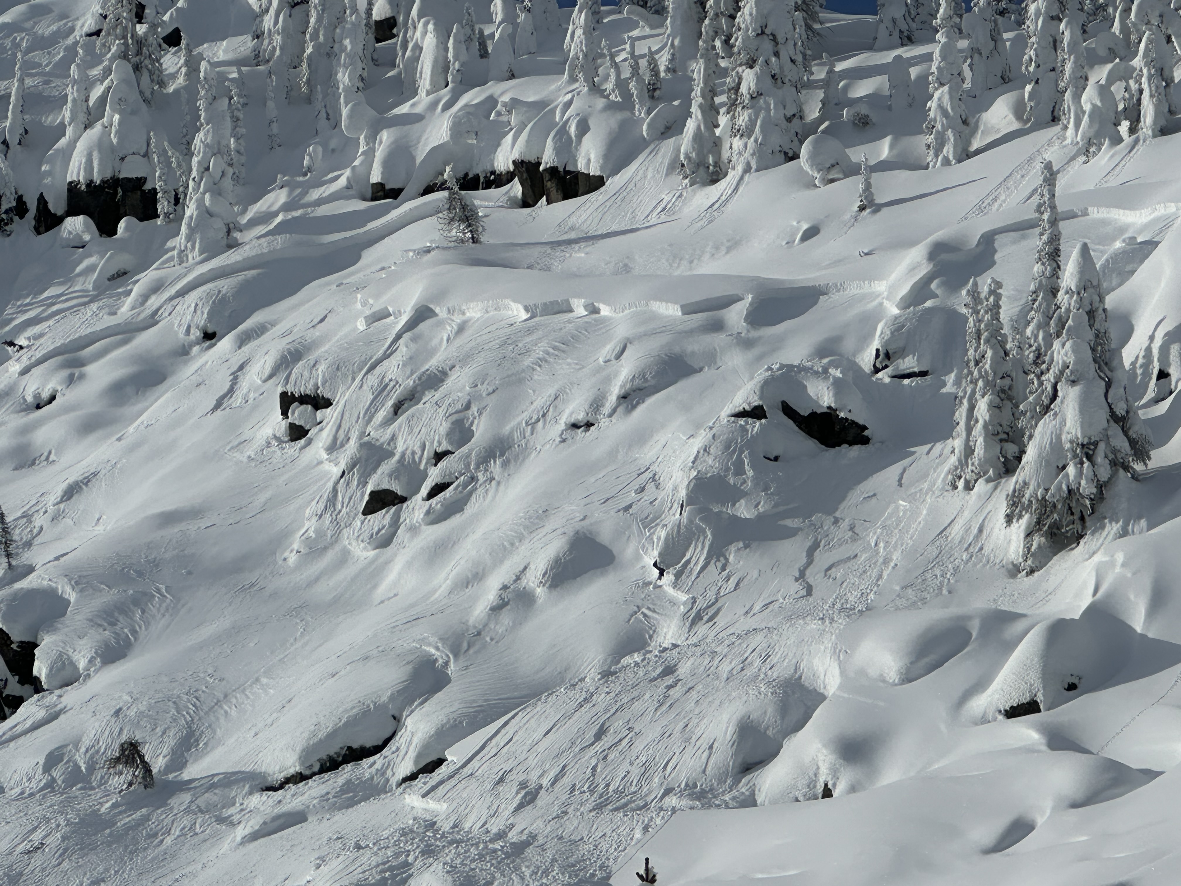
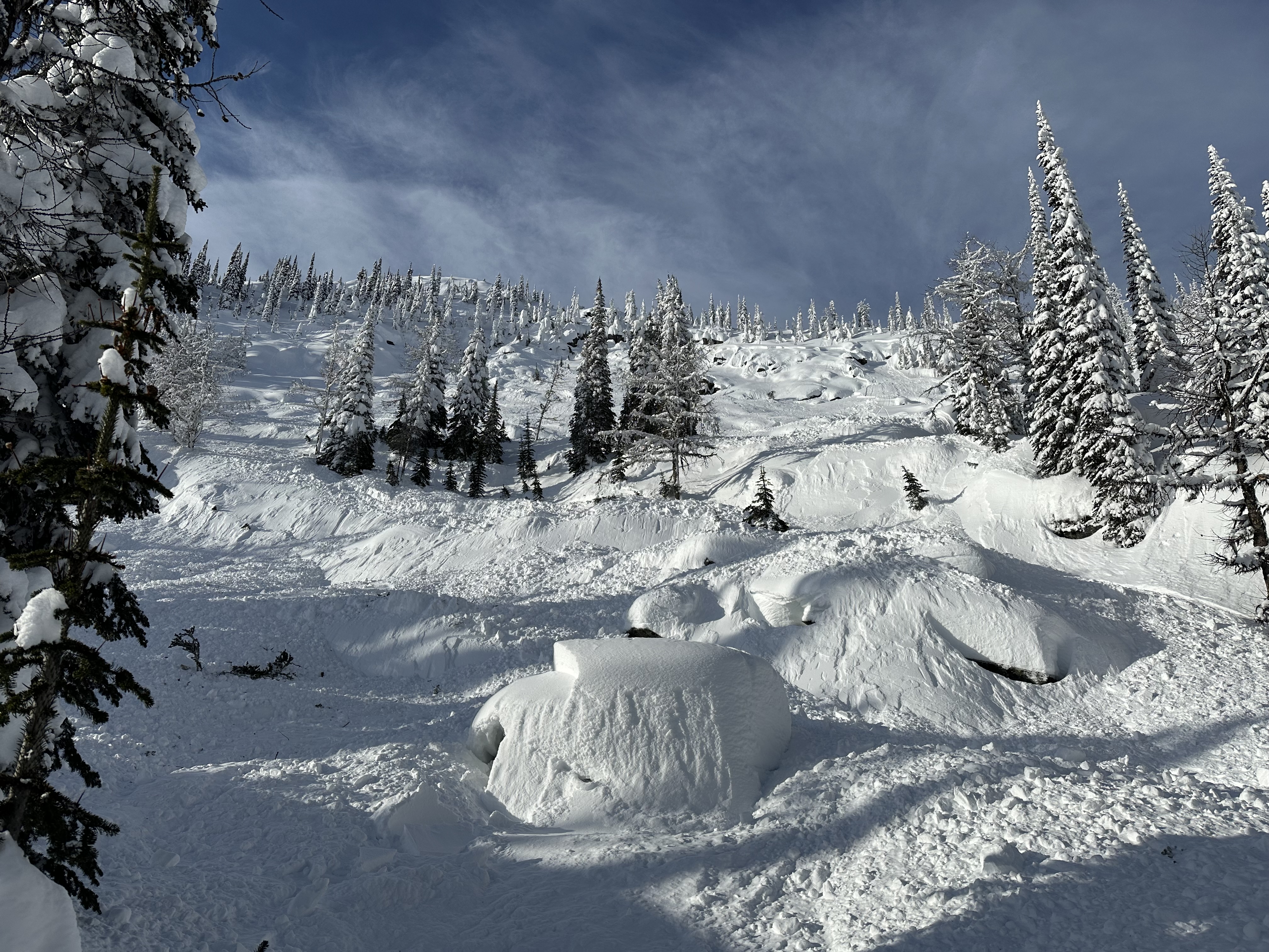
Rider triggered near top of NE slope carried 10m stopping in trees.
Avalanche propagated on prominent crust layer. Slab was ~30-45cm deep, ~100m wide and ~200m long ran entire slope through trees to gulley the below. From ~2000m to ~1900m elevation.
Be safe out there!