- Submitted by
- sterling.christenson
- Observations date
- Tuesday, February 4, 2025 at 11:00
- Location
- 50.104807° N 123.256879° W
- Reporting on
- Snow conditions
%2F-123.25687851239813%2C50.10480736987594%2C8%2C0%2C0%2F1026x200%3Faccess_token%3Dpk.eyJ1IjoiYXZhbGFuY2hlY2FuYWRhIiwiYSI6ImNqd2dvZmUxdzE4ZWg0M2tkaXpuNG95aTQifQ.pBLM87fE3sIxRJqJT7Bf7g&w=1200&q=75 "Brandywine slide")
Quick
Avalanche
Snowpack
Weather
Incident
Information
- Avalanche date/time
- Tuesday, February 4, 2025 at 11:00
- Estimated occurrence time of avalanche
- Less than 12 hours ago
- Number of avalanches in this report
- 1
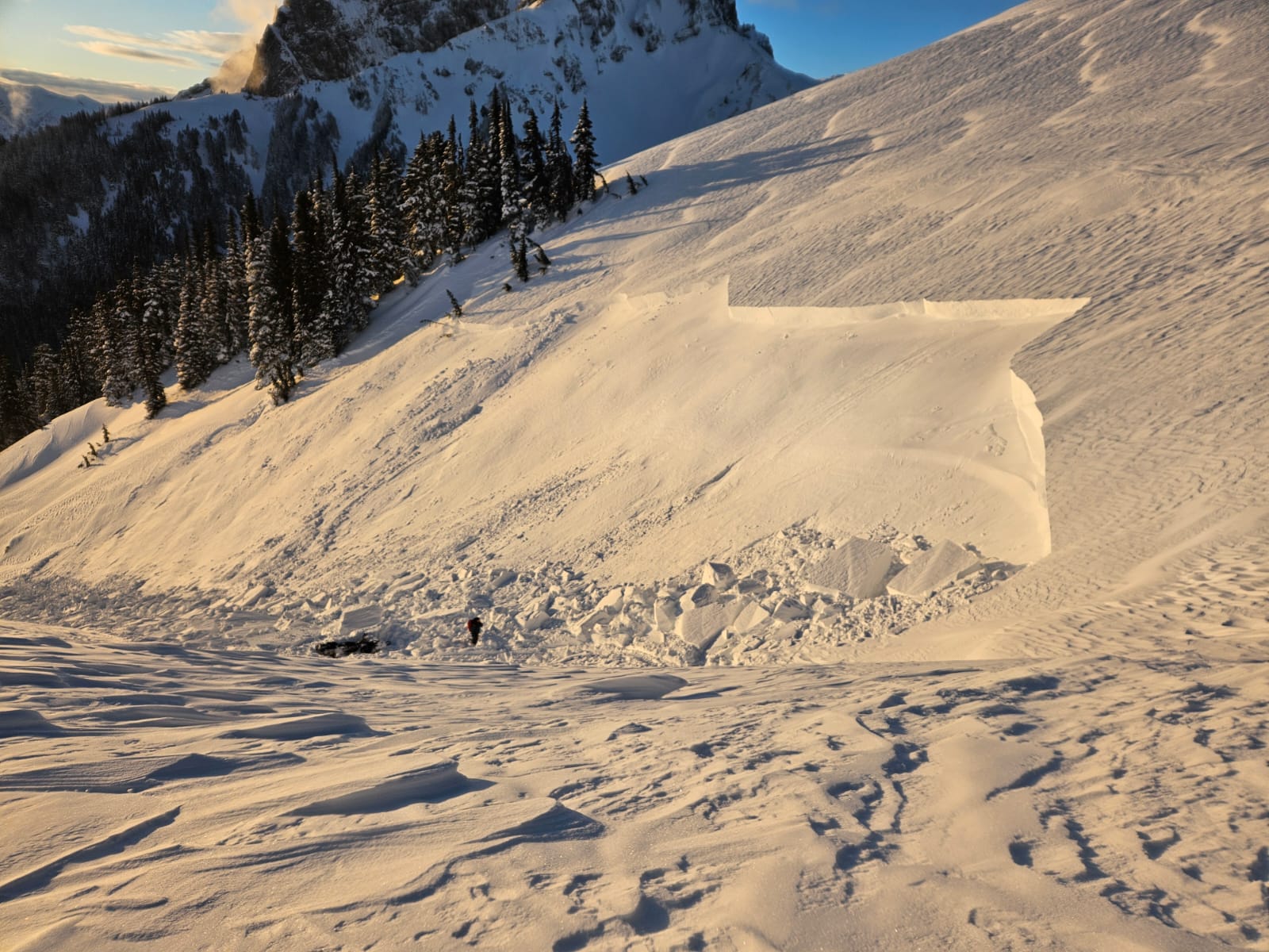
- The size of avalanche
- 2.5
- Slab thickness
- 160cm
- Slab width
- 30m
- Run length
- 30m
- Avalanche Character
- Storm slab
- Wind slab
- Trigger type
- Snowmobile
- Trigger subtype
- Accidental
- Remote trigger distance
- 10m
- Start zone aspect
- S
- Start zone elevation band
- Alpine
- Start zone elevation
- 1,675m
- Start zone incline
- 30°
- Runout zone elevation
- 1,660m
- Weak layer burial date
- Thursday, January 30, 2025
- Weak layer crystal type
- Surface hoar and facets
- Crust near weak layer
- Yes
- Wind exposure
- Cross-loaded slope
- Vegetation cover
- Open slope