- Date
- Thursday, May 4, 2017
Large Avalanches Hitting Green Grass
The snowpack at upper elevations in western Canada are still more like winter than spring. In many locations snow depths are well above average and showing no sign yet of beginning to melt.
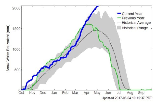
Redfish Creek Snow Pillow Graph (2086m) May 4, 2017: BC River Forecast Centre.
This is the result of a cold winter and a spring with significant amounts of precipitation that has fallen as snow at higher elevations. The lack of warm temperatures means the snow at higher elevations still has complex layering. Usually, spring-time temperatures would have caused the snow to settle and promoted bonding by this time of year.
Now, the first big warming event of the spring is underway and that complex snowpack is failing. Large avalanches are starting at high elevations and running to valley bottom, even into areas where the grass is green and the leaves are out.
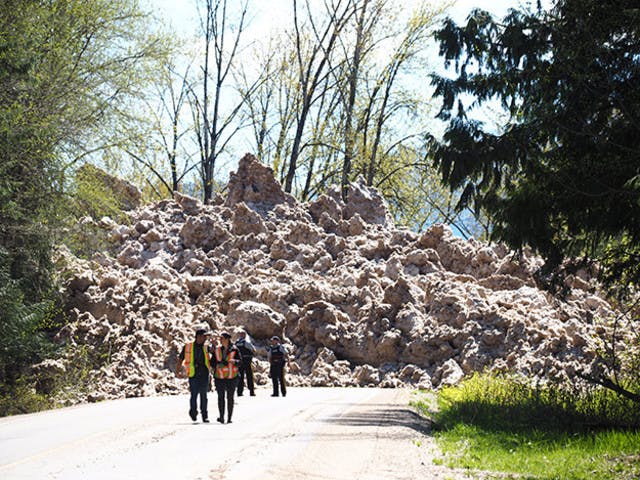
Avalanche on the Greenslide Path south of Revelstoke, My 4, 2017. Photo: Revelstoke Review
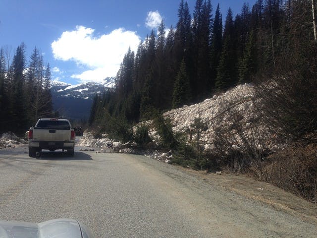
BC Highway 99, May 4, 2017. Photo: Tara Merrie
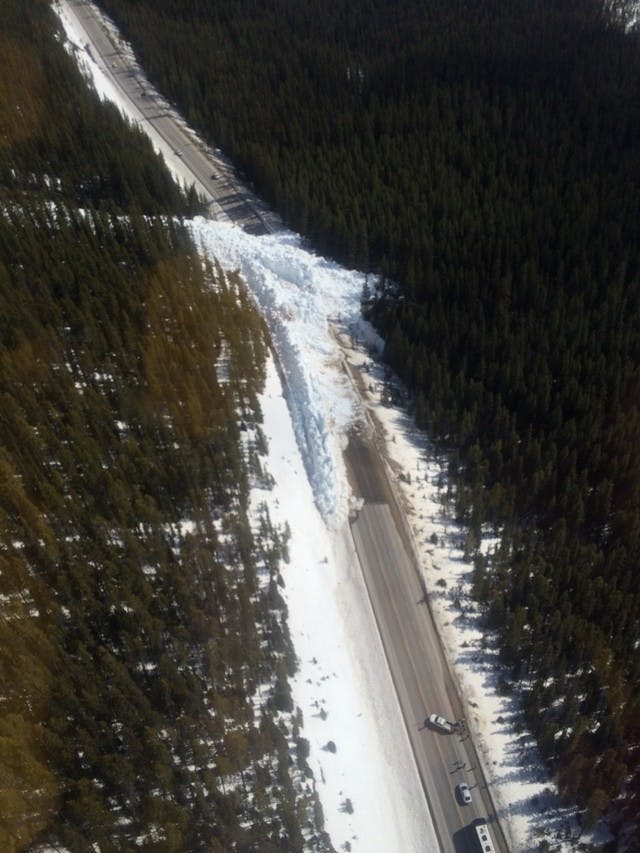
Highway 93, Banff National Park, May 4, 2017. Photo: Parks Canada
Click here to see a video of a recent avalanche in the western Rocky Mountains.
The warming has only just begun and will likely only affect southern regions of BC and Alberta in this first round. But this condition will become problematic in other areas as the warming trend spreads to other areas.
These events are a good reminder that just because there’s no snow or steep terrain where you are standing doesn’t mean there’s no avalanche hazard. Given the winter we’ve just experienced and the late spring, I suspect this might be just the preliminary warning shot across the bow. It will take an extended spell of warmer days and cool nights to promote the repeated melting and re-freezing cycles it will take to stabilize this condition. And we'll need to see the upper elevation snowpack to melt much farther back before the valley bottom threat is gone. So I'm pretty sure these kinds of events will continue to occur for the next few weeks.
Staying safe in these conditions is all about timing and recognizing avalanche paths below treeline. Things are generally safer on cold days or at night when the snow is frozen. When the sun is hitting large alpine slopes above or when temperatures rise and the snowpack begins to warm up and melt, danger increases. If in doubt, don’t expose yourself to large avalanche paths even if there’s no snow at your elevation and it seems the snowline is far above you. And at all times never stop in runout zones and don’t group up there; always move quickly through these areas and spread out or go one at a time.
Click here to see a blog post that discusses spring conditions and how to manage them, and which also includes links to more detailed advice about typical scenarios that occur at this time of year.
Keep looking up and stay safe this spring.
Karl Klassen
Avalanche Canada Warning Service Manager
kklassen@avalanche.ca