- Submitted by
- gareth.wheats
- Observations date
- Monday, February 10, 2025 at 22:15
- Location
- 49.614020° N 121.160290° W
- Reporting on
- Snow conditions
/-121.16029,49.61402,8,0,0/1026x200?access_token=pk.eyJ1IjoiYXZhbGFuY2hlY2FuYWRhIiwiYSI6ImNqd2dvZmUxdzE4ZWg0M2tkaXpuNG95aTQifQ.pBLM87fE3sIxRJqJT7Bf7g "Coquihalla Summit Rec Area - Specific terrain feature found...")
Information
- Activity
- Skiing
Group details
- Total in the group?
- 2
- People fully buried?
- 0
- People partly buried with impaired breathing?
- 0
- People partly buried with normal breathing?
- 1
- People not injured (caught but not buried)?
- 0
- People injured (caught but not buried)?
- 0
- People involved?
- 1
Terrain details
- Terrain shape at trigger point
- Planar
- Snow depth at trigger point
- Average
- Terrain traps
- Trees
Comments
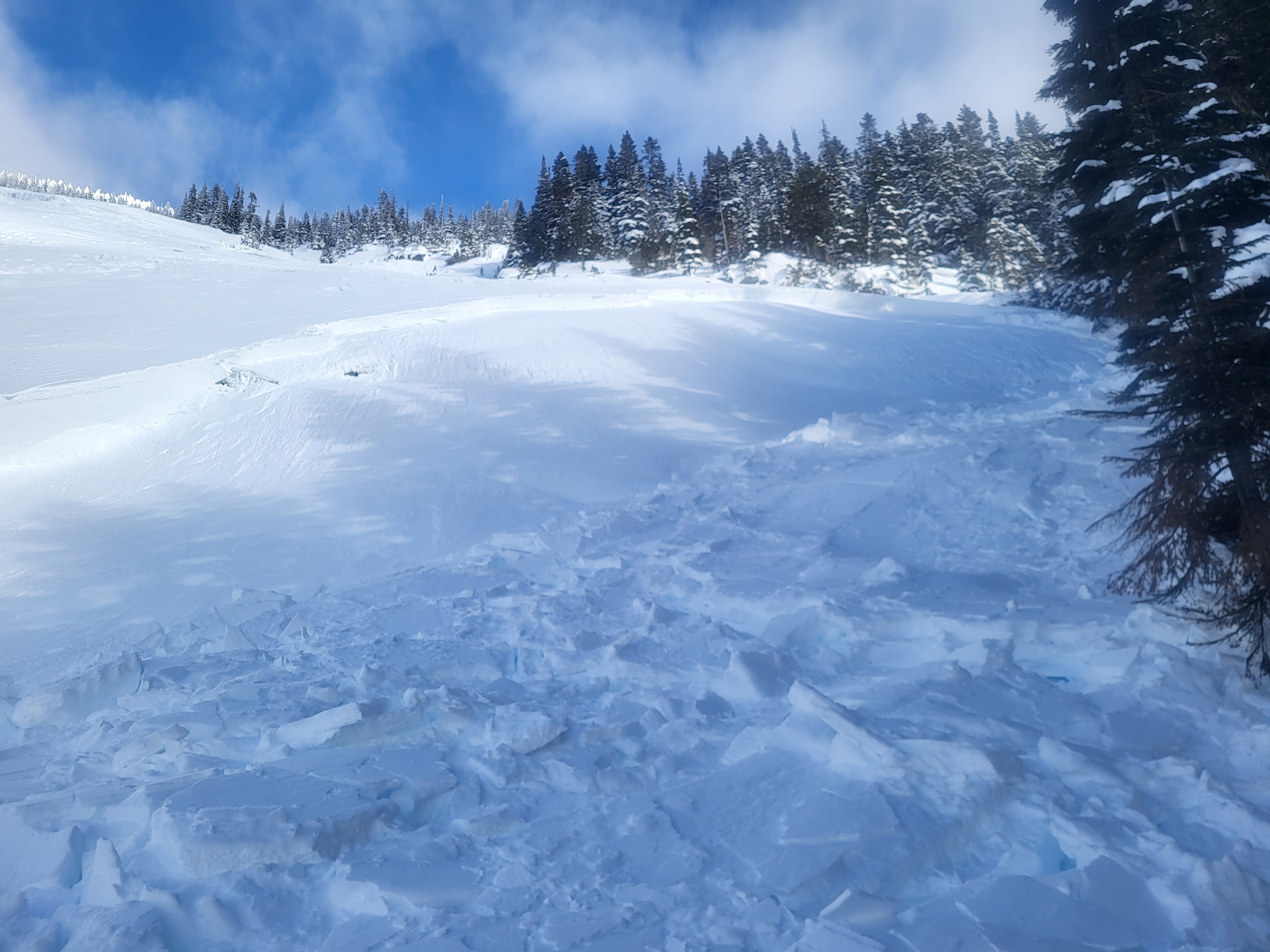
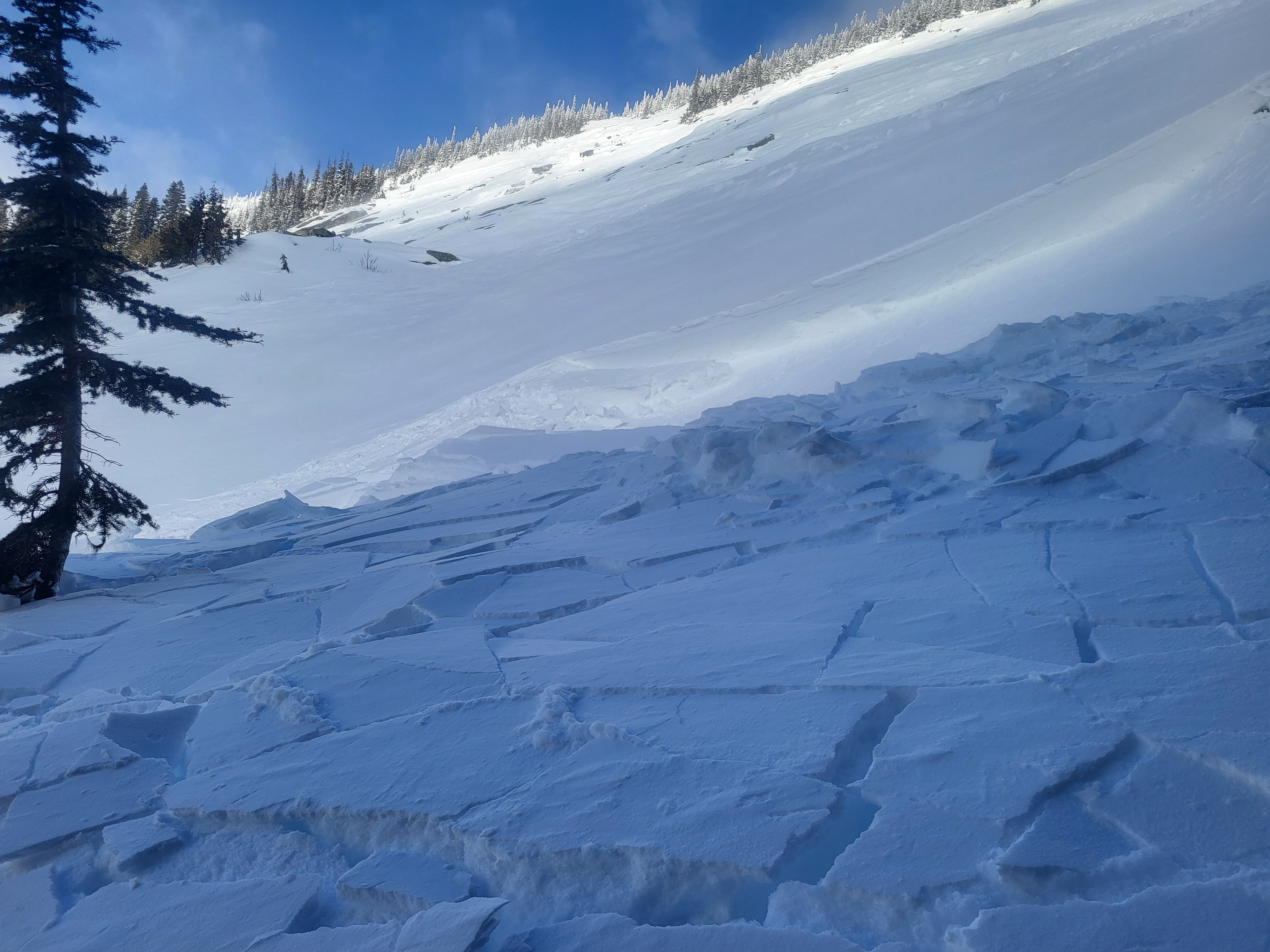
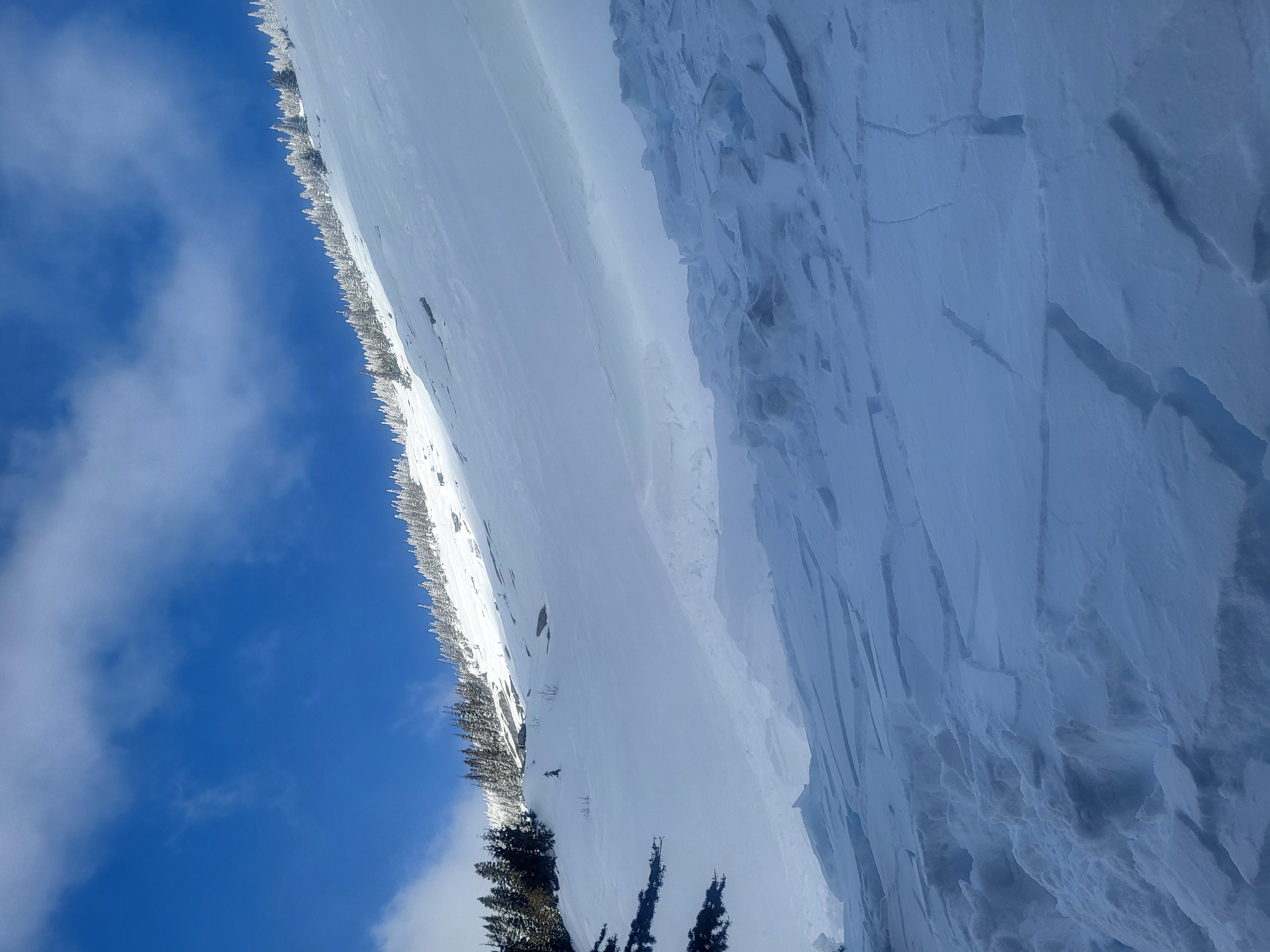
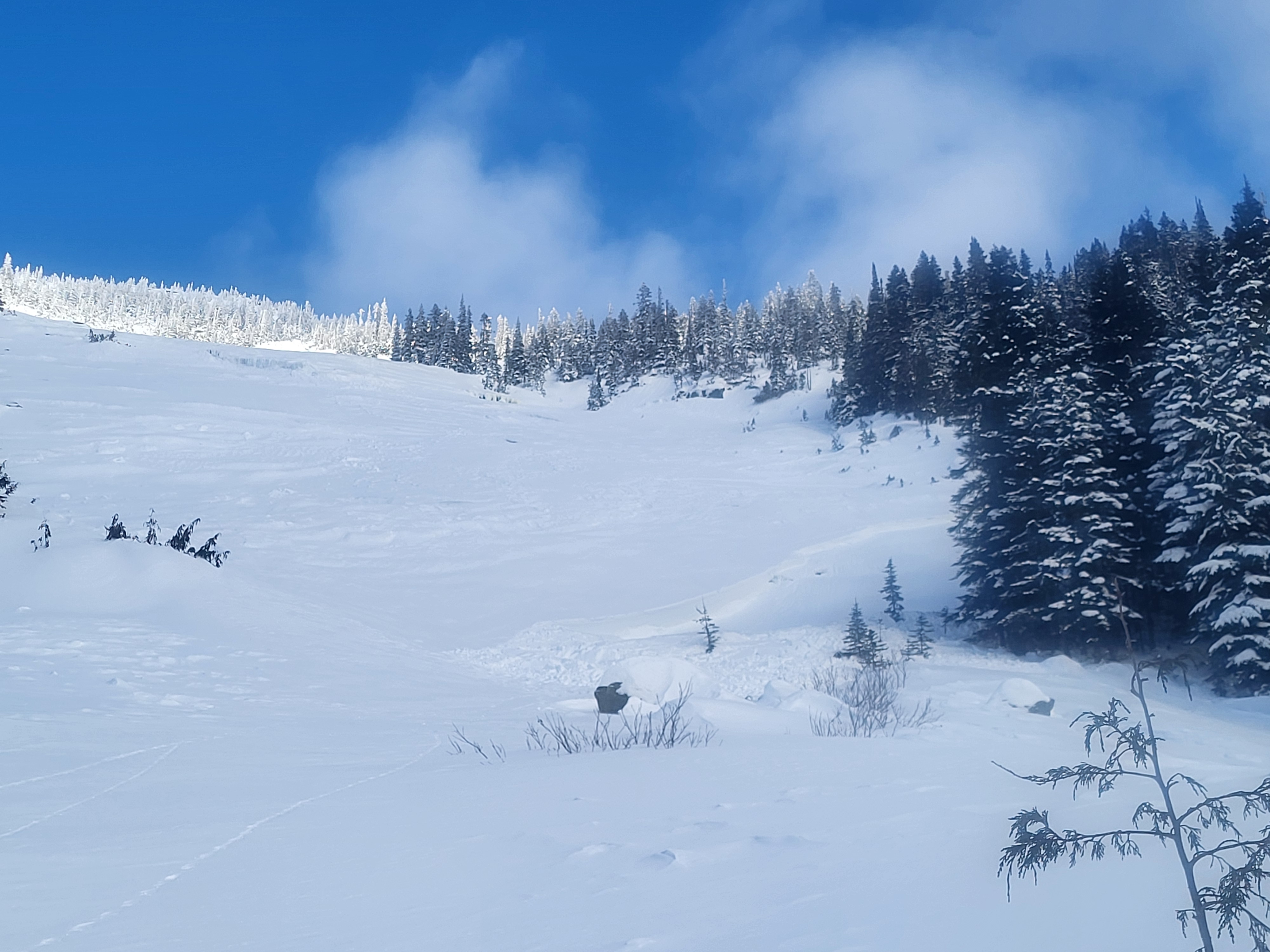
Convex roll was identified and skiers went far skiers left to descend in the more concave/planar portion of the slope, along the tree line. First skier descended and took a position below with easy access to tree cover.
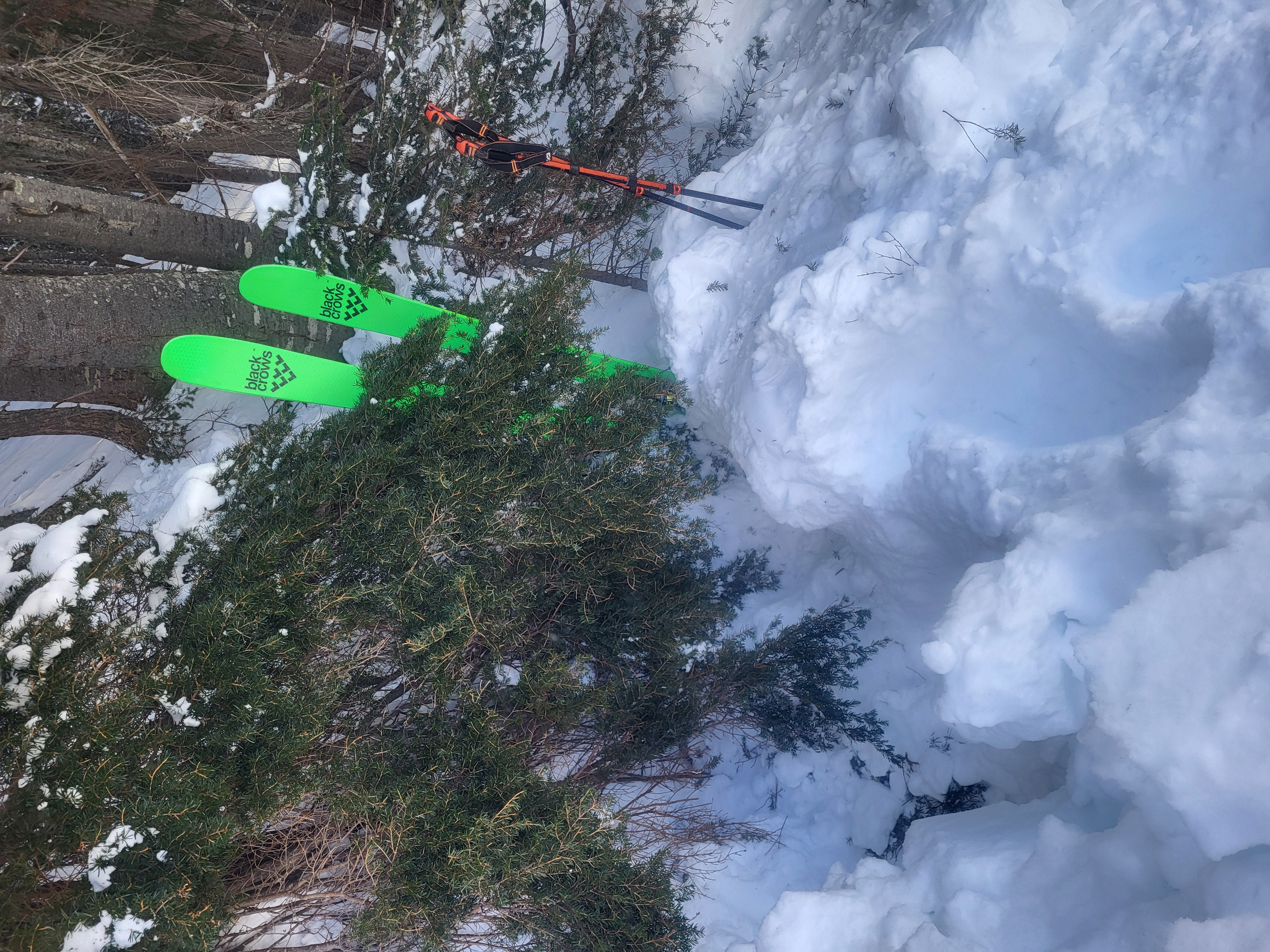
Second skier descended, threading the first set of tracks and initiated the slide on the second turn which was slightly further skiers right than the first descent line. Skier recognized the breaking up of the slab, yelled "SLIDE, SLIDE, SLIDE". First skier cut into the trees and into a safe zone, second skier skied into and behind a tree and held onto branches as debris came and partially buried the seconded skier. Second skier was buried to the waist and self extricated. All equipment was recovered and not damaged, no injuries.
Where the slab was initiated, the crown line was approximately 40-50cm thick and propagated out into a wind loaded pocket of 1.5-1.75m deep over some rocks. Approximate slide was 60m across and ran for about 60m. slightly longer than it was wide. Very obvious wind slab, likely slide on the January crust.
Skiers debriefed in the trees, descended safely and back to the Iago/Zupjock notch and onwards to Iago.