- Submitted by
- AMcLeod
- Observations date
- Monday, February 24, 2025 at 21:00
- Location
- 49.536531° N 116.124267° W
- Reporting on
- Snow conditions
/-116.12426651417807,49.53653145654397,8,0,0/1026x200?access_token=pk.eyJ1IjoiYXZhbGFuY2hlY2FuYWRhIiwiYSI6ImNqd2dvZmUxdzE4ZWg0M2tkaXpuNG95aTQifQ.pBLM87fE3sIxRJqJT7Bf7g "Angus")
Quick
Avalanche
Snowpack
Weather
Incident
Information
- Avalanche date/time
- Monday, February 24, 2025 at 21:00
- Number of avalanches in this report
- 1
- The size of avalanche
- 2
- Slab width
- 75m
- Avalanche Character
- Storm slab
- Wind slab
- Trigger type
- Skier
- Trigger subtype
- Remote
- Start zone aspect
- NE
- Start zone elevation band
- Treeline
- Start zone elevation
- 2,370m
- Start zone incline
- 35°
- Runout zone elevation
- 2,150m
- Wind exposure
- Lee slope
- Vegetation cover
- Open slope
Comments
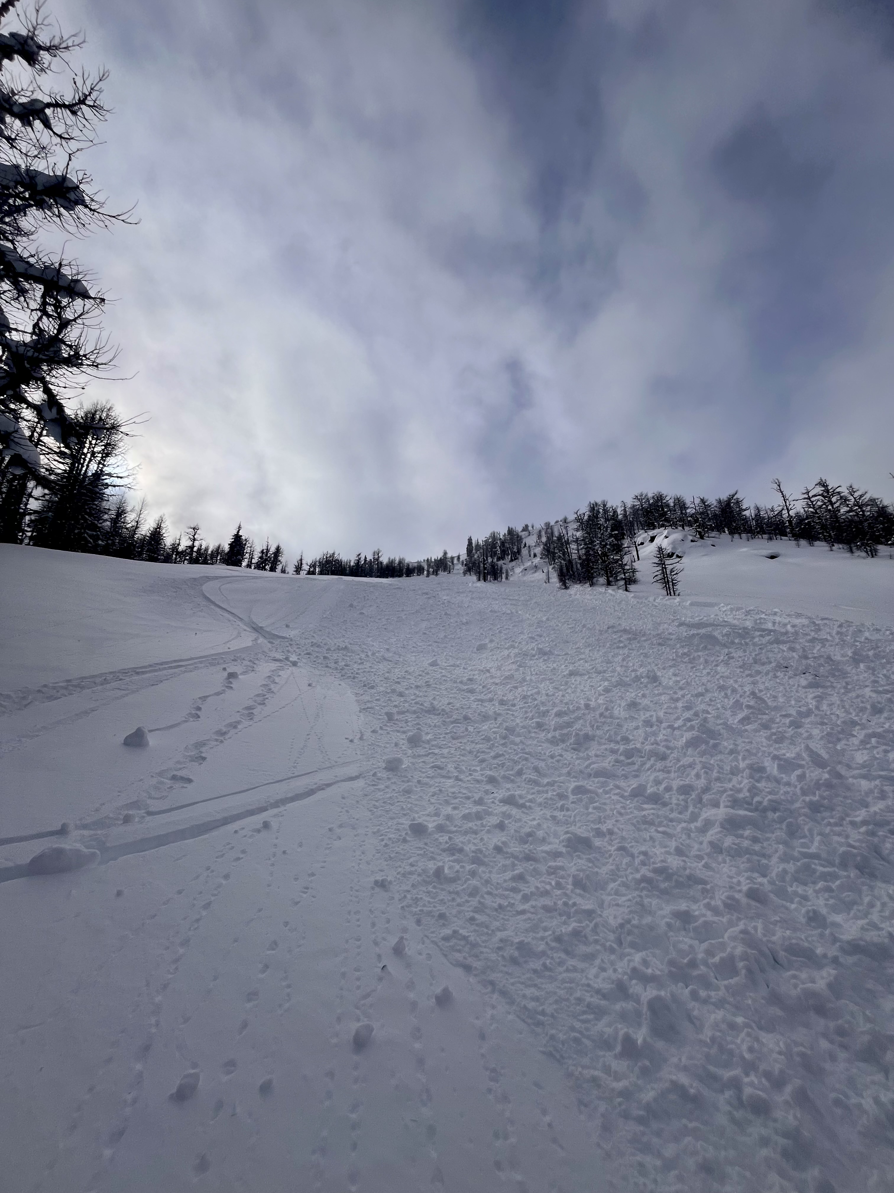
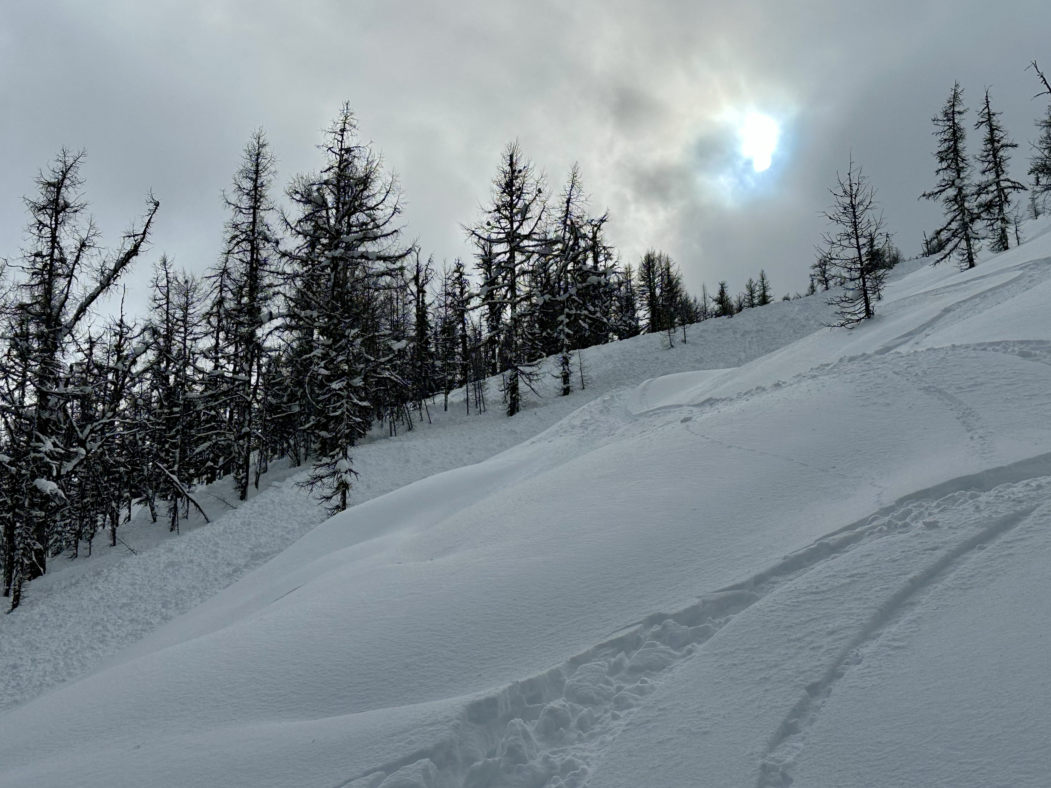
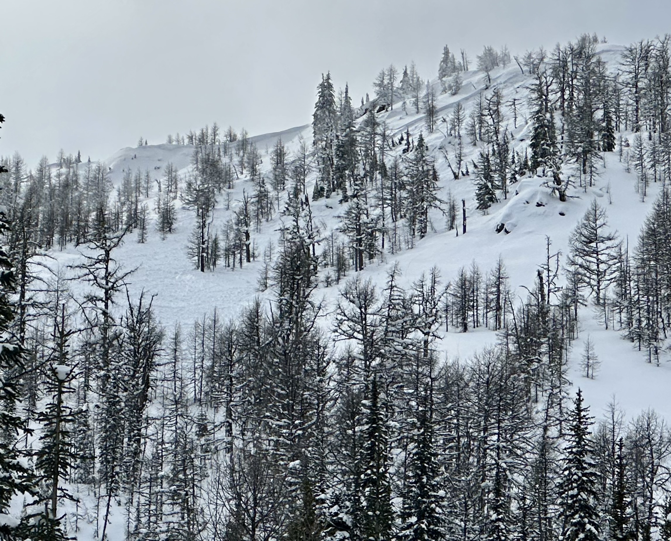
Remote triggered the steep lee ridge feature above our ski line on the last run of the day. Debris travelled over many of the ski tracks on the open slope below that we had previously laid down.
Pushing close to steeper wind loaded terrain as the day went on was our mistake.