- Credit
- Penn State University Meteorology Department
- Credit
- Environment and Climate Change Canada
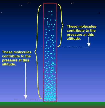
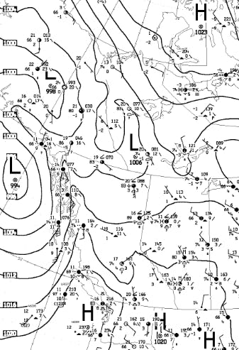
Atmospheric pressure is a fundamental weather element and refers to the weight of a column of air pressing down on a given area. It is commonly expressed in units of millibars (mb). A surface weather map shows the pressure pattern as measured by weather stations (converted to sea level pressure to eliminate changes in elevation) across the globe, with isobars connecting points of equal pressure.
Not only does the current pressure pattern act as a useful indicator of likely weather, but changes in the pressure pattern indicate the weather that is likely to come.
If pressure is falling, it usually signifies the approach of a low pressure system, and its associated deteriorating weather.
Rising pressure comes with many meanings. Following a passing front or low pressure system, surface pressure rises and conditions generally improve. However, a rapid increase in pressure may bring a burst of strong winds. In winter, an arctic ridge of high pressure seeping down from the north may bring harsh temperatures and persistent valley cloud, but sunshine in the alpine.