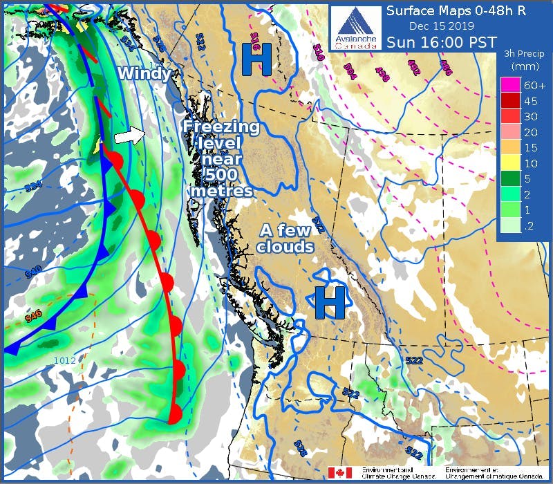
- Credit
- Environment and Climate Change Canada
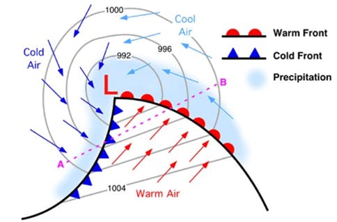
- Credit
- M. Pidwirny
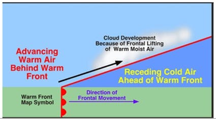
- Credit
- M. Pidwirny
A warm front is the interface that occurs when a warm air mass replaces a retreating cold air mass. Warm fronts generate atmospheric lift as their associated low-density air mass climbs up and over the cooler, denser air it advances upon. This gradual overrunning of warm, moist air produces clouds and precipitation well ahead of the warm front’s surface position. Warm fronts are represented on weather maps by a solid red line with red semicircles pointing in the direction the front is moving.
See also: