- Credit
- Encyclopedia Brittanica
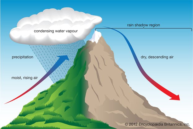
Orographic lift takes place when a moving mass of air encounters a physical barrier such as a mountain range and is forced upwards. The rising air cools, condenses and forms clouds. With sufficient lift and moisture, precipitation generally falls on windward slopes and/or near mountain peaks. On the leeward side of mountains (downwind), air descends, warms, becomes drier, and creates an area of lower precipitation, commonly called a rain shadow.
Since the predominant wind direction in the mid-latitudes of North America is from west to east, orographic lift is a key component of precipitation patterns and snowpack depth. Consequently, western-facing (windward) slopes experience higher annual precipitation accumulations than eastern-facing (lee) slopes. Pacific frontal systems will also wring out a larger percentage of their moisture content over the Coast Mountains, with less moisture available to fall over the Columbia and Rocky Mountain ranges.
See also: