- Soumis par
- Yukon Field Team
- Date d'observation
- vendredi 23 février 2024 à 19 h 00
- Localisation
- 59.699220° N 135.103470° W
- Rapport concernant
- Conditions de neige
/-135.10347,59.69922,8,0,0/1026x200?access_token=pk.eyJ1IjoiYXZhbGFuY2hlY2FuYWRhIiwiYSI6ImNqd2dvZmUxdzE4ZWg0M2tkaXpuNG95aTQifQ.pBLM87fE3sIxRJqJT7Bf7g "Winds slab forming on North aspects")
Express
Avalanche
Manteau neigeux
Météo
Incident
Conditions de neige
- La qualité du hors-piste était:
- OK
- Les conditions de neige étaient :
- Croûtée
- Affectée par le vent
- Nous avons parcouru:
- Pentes alpines
Information
- La journée était:
- Nuageuse
- Ensoleillée
- Venteuse
- Conditions d'avalanche
- Avalanches de plaque datant d'aujourd'hui ou d'hier.
Commentaires
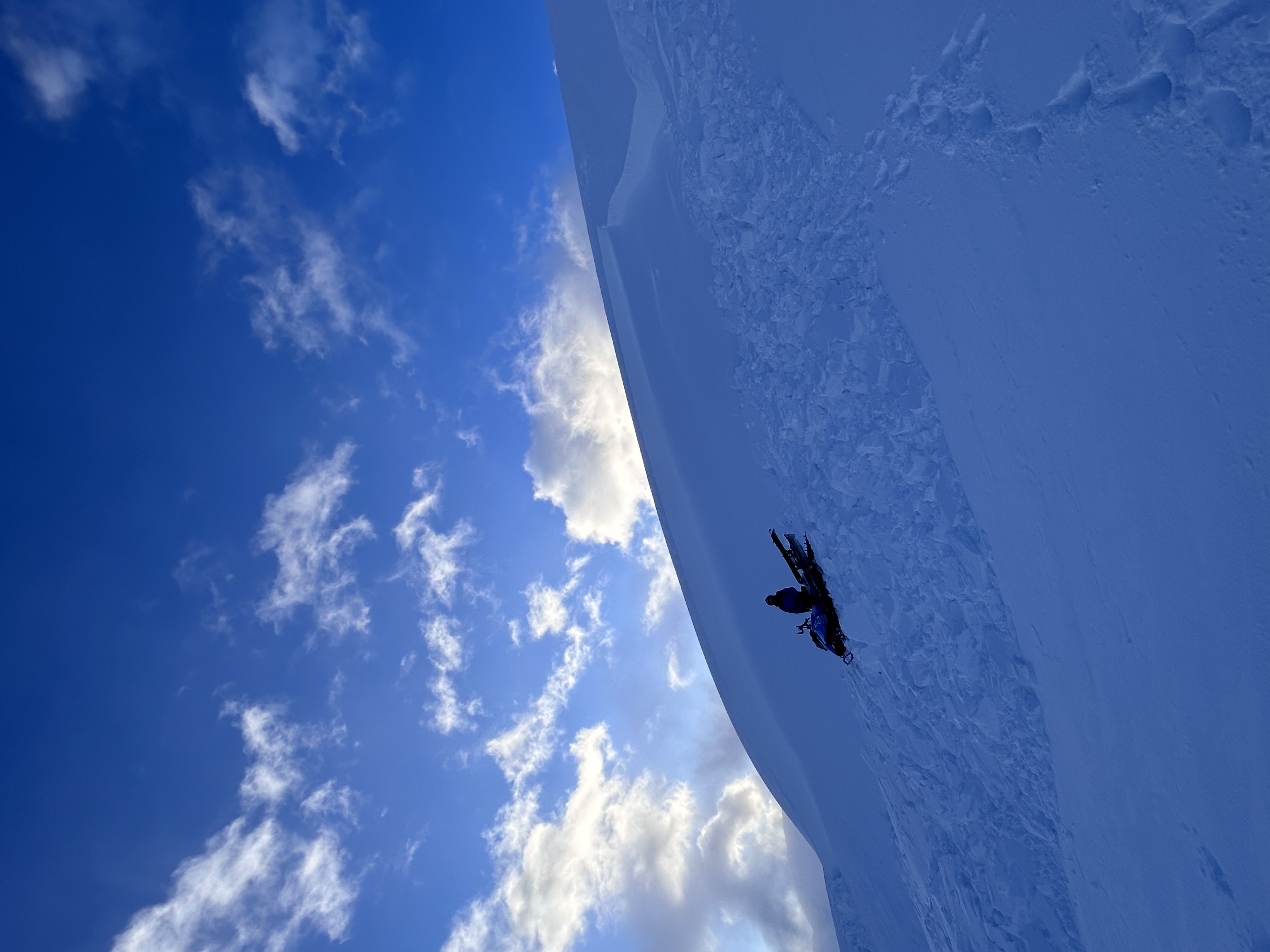
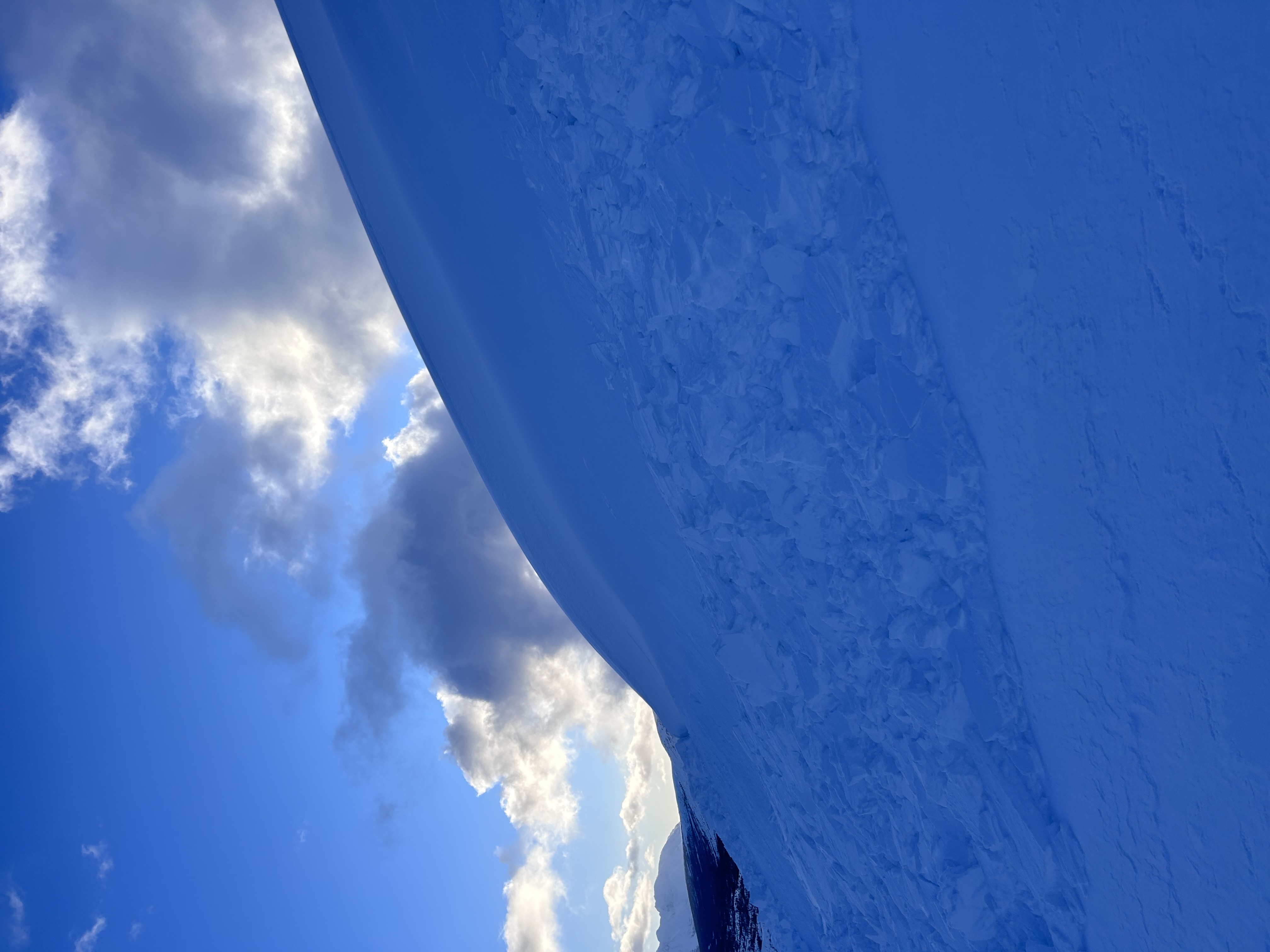
There has been 20 cm of fresh snow at Fraser in the past 48 hours and strong gusting to extreme southerly winds. We had a ride out to the Summit WX station this morning expecting some softer riding conditions but as soon as we got out of the treeline we predominantly wind effected surfaces in the alpine. Heading down from the Summit WX station we remotely triggered a deep wind slab on a convex roll (see photo attached). This was on a North aspect at 1060 meters. The snow and strong winds over the previous days have made wind slabs ripe for triggering! Windslabs will need a few days to heal and bond. There was still non wind effected snow in the trees and riding quality was much better there. Be cautious of unsupported north-facing terrain features in the coming days.