- Soumis par
- Hyland Backcountry
- Date d'observation
- mardi 14 avril 2026 à 19 h 00
- Localisation
- 54.867410° N 127.535590° W
- Rapport concernant
- Conditions de neige
%2F-127.53559%2C54.86741%2C8%2C0%2C0%2F1026x200%3Faccess_token%3Dpk.eyJ1IjoiYXZhbGFuY2hlY2FuYWRhIiwiYSI6ImNqd2dvZmUxdzE4ZWg0M2tkaXpuNG95aTQifQ.pBLM87fE3sIxRJqJT7Bf7g&w=1200&q=75 "Hankin Pk - E Bowl Avalanche Details")
Information
- Date/heure de l'avalanche
- vendredi 10 avril 2026 à 18 h 30
- Estimation de l'heure d’occurrence de l’avalanche
- > 48 heures
- Nombre d'avalanches dans ce rapport
- 1
- Taille de l’avalanche
- 3.5
- Largeur de la plaque
- 600m
- Longueur d'écoulement de l'avalanche
- 500m
- Caractère de l'avalanche
- Plaque profonde et persistante
- Versant de la zone de départ
- E
- Bande d'altitude de la zone de départ
- Alpin
- Altitude de la zone de départ
- 1 750m
- Altitude de la zone de dépôt
- 1 500m
- Date d'ensevelissement de la couche fragile
- samedi 7 février 2026
- Type de cristaux de la couche fragile
- Grains à faces planes
- Croûte près d'une couche fragile
- Oui
- Exposition au vent
- Pente sous le vent
- Couverture forestière
- Pente dégagée
Commentaires
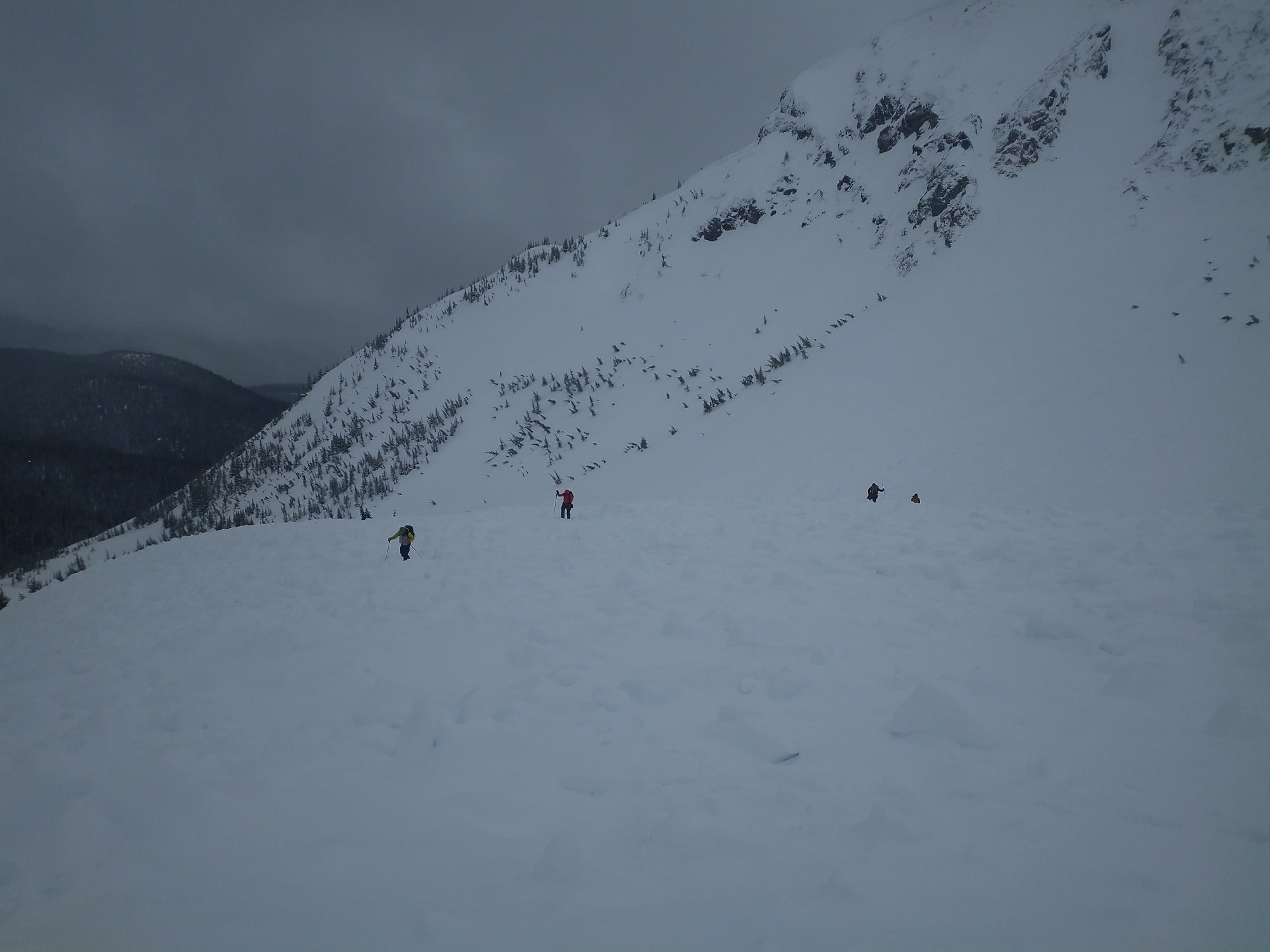
I took an avalanche class out to view the Avalanche that occurred at Hankin on Friday, April 10 (See MIN Report for photos).
The avalanche occurred on the East flank of Hankin Pk proper, approx 1.5km west of the warming Hut.
We spent some time at first on the debris, discussing what a rescue would look like, and the challenges would be on such a large debris field. Then we went up to the crown and did a Fracture Line Profile.
The trigger for this avalanche is unknown, speaking to the reporting party, it could have been a skier remote trigger from the flats above, or possibly a Natural from daytime heating or cornice fall, but their was no obvious cornice failure near the crown. We probed along the flats above the crown, and found variable depth, and several spots only 120cm total snowpack depth - this would put the layer down @ 50-60cm, in range for skier triggering if the party skied over the shallow spot.
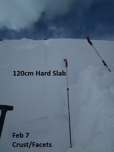
The avalanche occurred on an East, Alpine Bowl, starting zone elevation 1750m, with a total path length of 500m. The width was 600m wide. The fracture line was 100 - 300cm deep, and was a very hard slab. (P+) Our Fracture line Profile showed 120cm depth, and the Bed Surface was indeed the Feb 7 Crust/Facet PWL layer. The Failure plane was 1-2mm Facets near the crust. The slab was to hard to effectively perform any tests, but I suspect we would have had very hard to no results, given the depth and slab hardness.
The debris ran out onto a bench, and 1/3 of it filled a deep gully terrain trap. The debris field was 250m long x 70-100m wide, with a max depth est at 8-10m, avg depth 4-5m.
I called it a size 3.5 avalanche. Very humbling, and glad no one was involved.