- Soumis par
- AFEW
- Date d'observation
- dimanche 23 février 2025 à 23 h 00
- Localisation
- 51.073130° N 115.804370° W
- Rapport concernant
- Conditions de neige
/-115.80437,51.07313,8,0,0/1026x200?access_token=pk.eyJ1IjoiYXZhbGFuY2hlY2FuYWRhIiwiYSI6ImNqd2dvZmUxdzE4ZWg0M2tkaXpuNG95aTQifQ.pBLM87fE3sIxRJqJT7Bf7g "Twin Cairns Avalanche")
Information
- Activité
- Ski
Détails du groupe
- Nombre total de personne dans le groupe ?
- 4
- Nombre de personnes blessées (emportées mais non ensevelies) ?
- 1
- Nombre de personnes impliquées ?
- 1
Détails du terrain
- Forme du terrain au point de déclenchement
- Convexe
- Épaisseur de neige au point de déclenchement
- Moyenne
- Piège naturel
- Paroi rocheuse
Commentaires
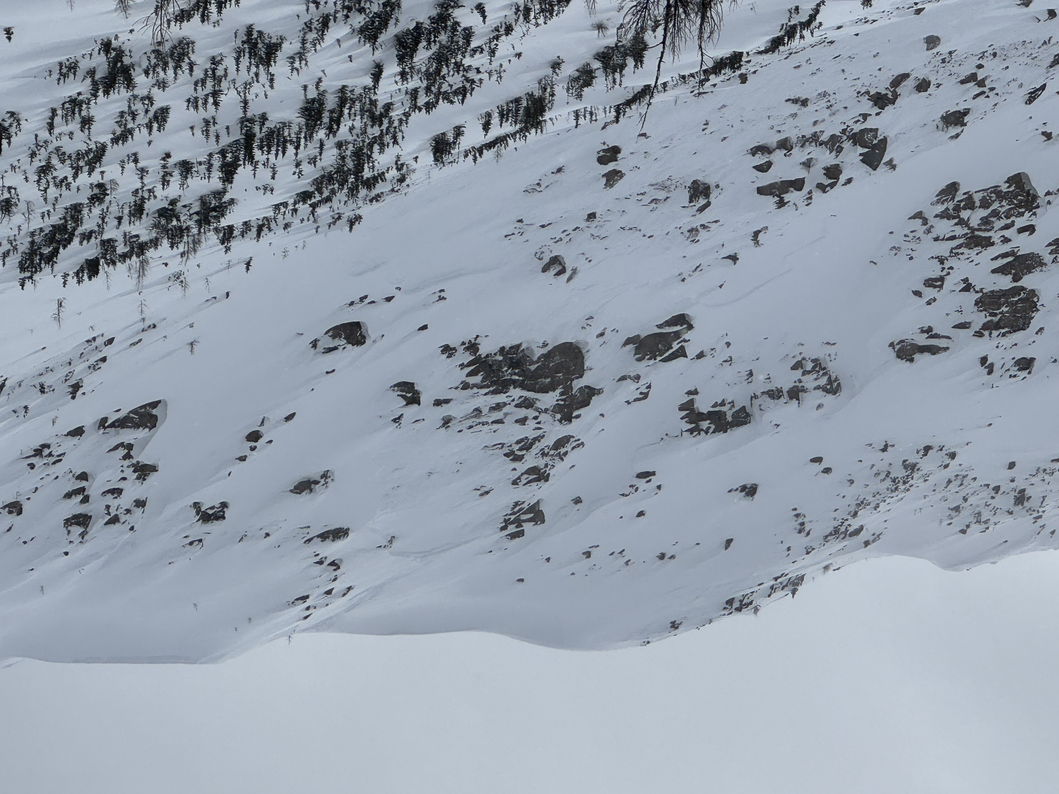
Ascended Twin Cairns. Strong eastward wind transport was observed, with cornices formed on leeward slopes.
A snowboarder initiated descent on a convex roll into the steep East face, triggering a wind slab failure. The crown appears to be visible in two sections, possibly indicating a step-down failure which propagated into a larger avalanche (sz 2). The snowboarder was caught, carried over cliffs, and sustained some impact injuries but was able to self-rescue.
Multiple whumphs, shooting cracks, and settlements were observed on the ridge before and after the incident. Given the considerable hazard rating, forecasted wind slabs, and ongoing snow transport, this terrain choice carried significant risk. Parks Canada observed the slide.
This was a near-miss. Sharing this report to help inform others and reinforce the need for terrain discipline, communication, and conservative decision-making in similar conditions.