- Date
- Friday, December 20, 2024
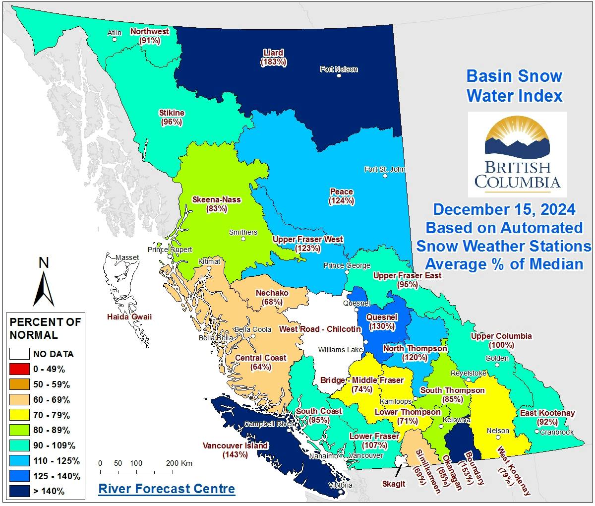
After several winters of low snowpacks and challenging avalanche conditions, this season has started with a refreshing return to "average." How average? As of December 15, the BC River Forecast Centre reported that the provincial snow depth was 102% of normal—about as typical as it gets!

Basin snow water index from the BC River Forecast Centre’s Snow Conditions Commentary for December 15.
November brought steady storms, building a solid snowpack without many notable weak layers or crusts. Most regions now have enough snow at treeline for great recreation: around 150 cm in the Coast and Columbias, and 100 cm in the Rockies.
Early December brought a dry spell, creating a mix of layers like surface hoar, rain crusts, and sun crusts. These layers can become problematic when buried, and while some avalanches have occurred on them, the issues seem sparse and likely short-lived in most areas. Recent activity has been most notable in BC’s southern Interior, particularly the southern Selkirks. Northeast of Pemberton is also suspect.

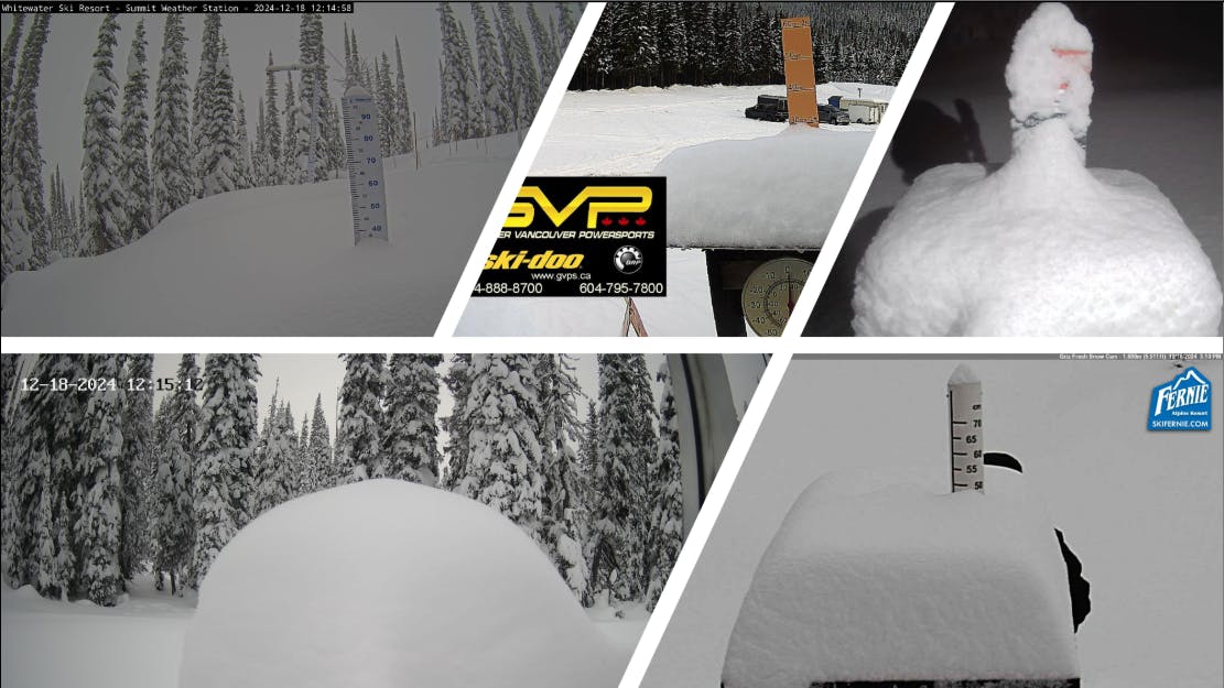
Webcams showing 25 to 50 cm of new snow on December 18.
December looks set to end with a bang. A storm on December 18 brought 25 to 50 cm of snow to southern BC and Alberta. And the action isn’t over yet—several frontal systems are lined up to bring more snow in the coming week.

The 500 mb forecast from the Mountain Weather Forecast shows a parade of storms hitting western Canada for the next week.
What to expect in the coming week? Avalanche danger will rise and fall with each storm as new snow and wind build reactive slabs. During storms, choose more conservative terrain and avoid steep, exposed areas. Afterward, start on low-angle slopes that are too small to produce large avalanches to assess the snowpack before considering venturing into steeper terrain.
What about the weak layers? In some regions, uncertainty remains about how long the early December weak layers will persist and which types of terrain will be most affected. Check your local forecast and if a persistent slab avalanche problem is listed, take a more conservative approach.
We’ll see what the rest of the season brings, but for now, we’ll gladly take an average snowpack without many significant weak layers. Wishing you a fun and safe holiday season!