Kootenay Pass
Observed Apr 15, 2026, 12:00 p.m. PDT · Selkirks
This report was submitted with an older form.
Quick report
- Comment
- Excellent skiing! Didn't feel the crust under the storm snow on N, NE, E, or SW slopes from 2200-1900m. Whumpfing and limited shooting cracks observed while breaking trail on uptracks, mostly in flatter terrain.
- Weather
- Cloudy, Stormy, Sunny
- Ride type
- Dense trees, Mellow slopes, Open trees, Steep slopes, Sunny slopes
- Stayed away
- Alpine slopes, Convex slopes, Steep slopes
- Riding quality
- Amazing
- Snow conditions
- Powder
- Avalanche conditions
- Avalanche condition slab, Avalanche condition snow, Avalanche condition sound
Avalanche report
- Comment
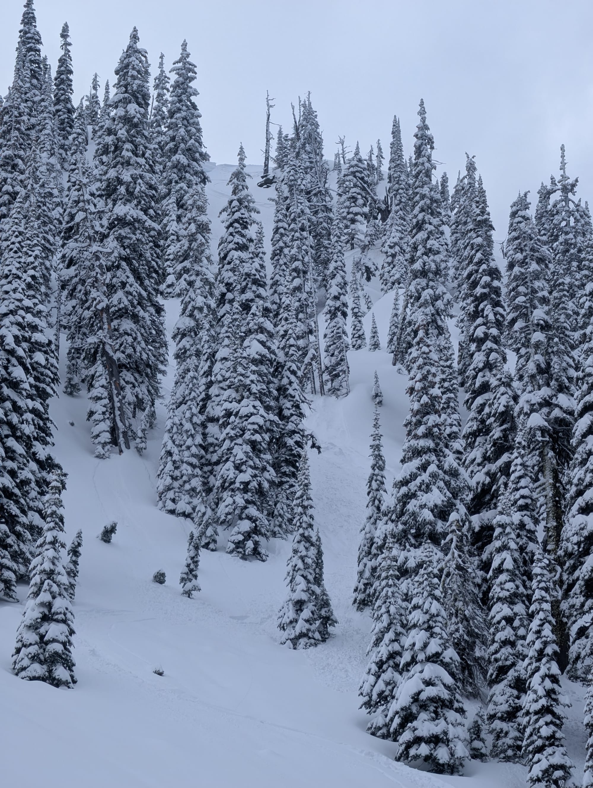
- Storm slab triggered on the second ski cut at the top of the ridge. Storm snow observed to be 30-40cms at ridge line on North aspects. I was expecting more of a sluff to start moving but the slab propagated ~3-4m on either side of me. Easily skied to my safe zone. Also observed several small (<5m) slabs release on NE, E, and NW aspects between 2200-1900m where the storm snow had consolidated a bit (sun or wind affected).
- Run length
- 100
- Slab width
- 8
- Trigger type
- Skier
- Wind exposure
- Lee slope
- Avalanche size
- 1
- Slab thickness
- 35
- Trigger sub type
- Intentional
- Start zone aspect
- N
- Vegetation cover
- Sparse trees
- Start zone incline
- 40
- Avalanche character
- Storm slab, Wind slab
- Crust near weak layer
- Yes
- Number of avalanches
- 2-5
- Start zone elevation
- 2080
- Runout zone elevation
- 2000
- Weak layer burial date
- 2026-04-14
- Start zone elevation band
- Tln
- Avalanche occurrence datetime
- 2026-04-15T19:00:00.000Z
Snowpack report
- Obs type
- Summary
- Site aspect
- N, NE
- Site elevation
- 2100
- Ski penetration
- 25
- Foot penetration
- 35
- Cracking observed
- Yes
- Test failure depth
- 35
- Site elevation band
- Tln
- Surface conditions
- New snow
- Whumpfing observed
- Yes
- Test failure layer crystal types
- Crust
Weather report
- Avg temp
- -3
- Wind speed
- Wind speed light
- Blowing snow
- Light
- Sky condition
- Broken clouds
- Snowfall rate
- 1
- Wind direction
- SW
- New snow24hours
- 25
- Storm start date
- 2026-04-14
- Temperature trend
- Steady
- Precipitation type
- Snow