- Submitted by
- M.T.
- Observations date
- Friday, April 17, 2026 at 21:00
- Location
- 60.551430° N 137.247340° W
- Reporting on
- Snow conditions
%2F-137.24734%2C60.55143%2C8%2C0%2C0%2F1026x200%3Faccess_token%3Dpk.eyJ1IjoiYXZhbGFuY2hlY2FuYWRhIiwiYSI6ImNqd2dvZmUxdzE4ZWg0M2tkaXpuNG95aTQifQ.pBLM87fE3sIxRJqJT7Bf7g&w=1200&q=75 "King’s Throne Avalanche")
Quick
Avalanche
Snowpack
Weather
Incident
Information
- Activity
- Skiing
Group details
- Total in the group?
- 2
- People fully buried?
- 0
- People partly buried with impaired breathing?
- 0
- People partly buried with normal breathing?
- 0
- People not injured (caught but not buried)?
- 2
- People injured (caught but not buried)?
- 0
- People involved?
- 2
Terrain details
- Terrain shape at trigger point
- Concave
- Snow depth at trigger point
- Shallow
- Terrain traps
- Trees
Comments
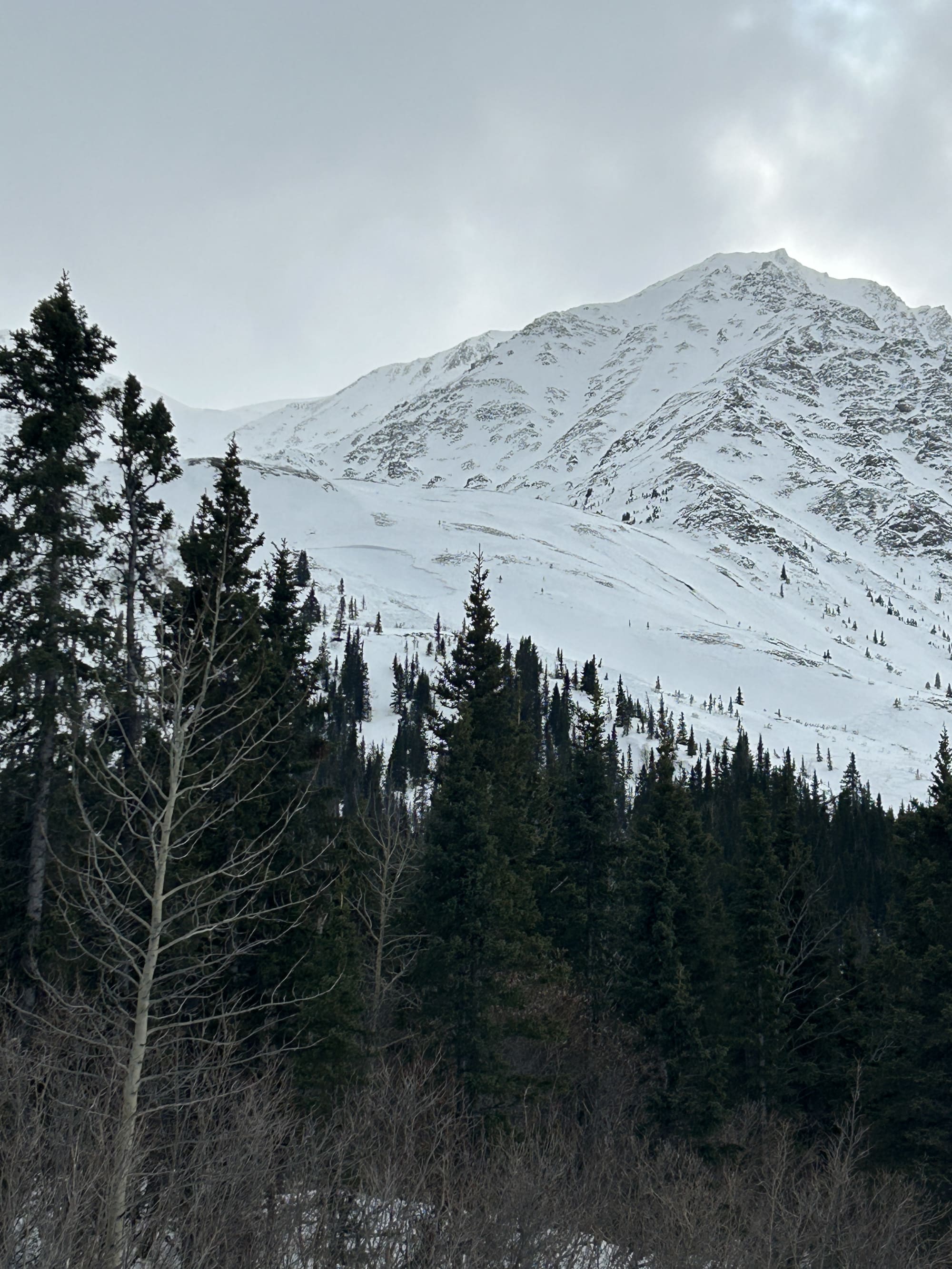
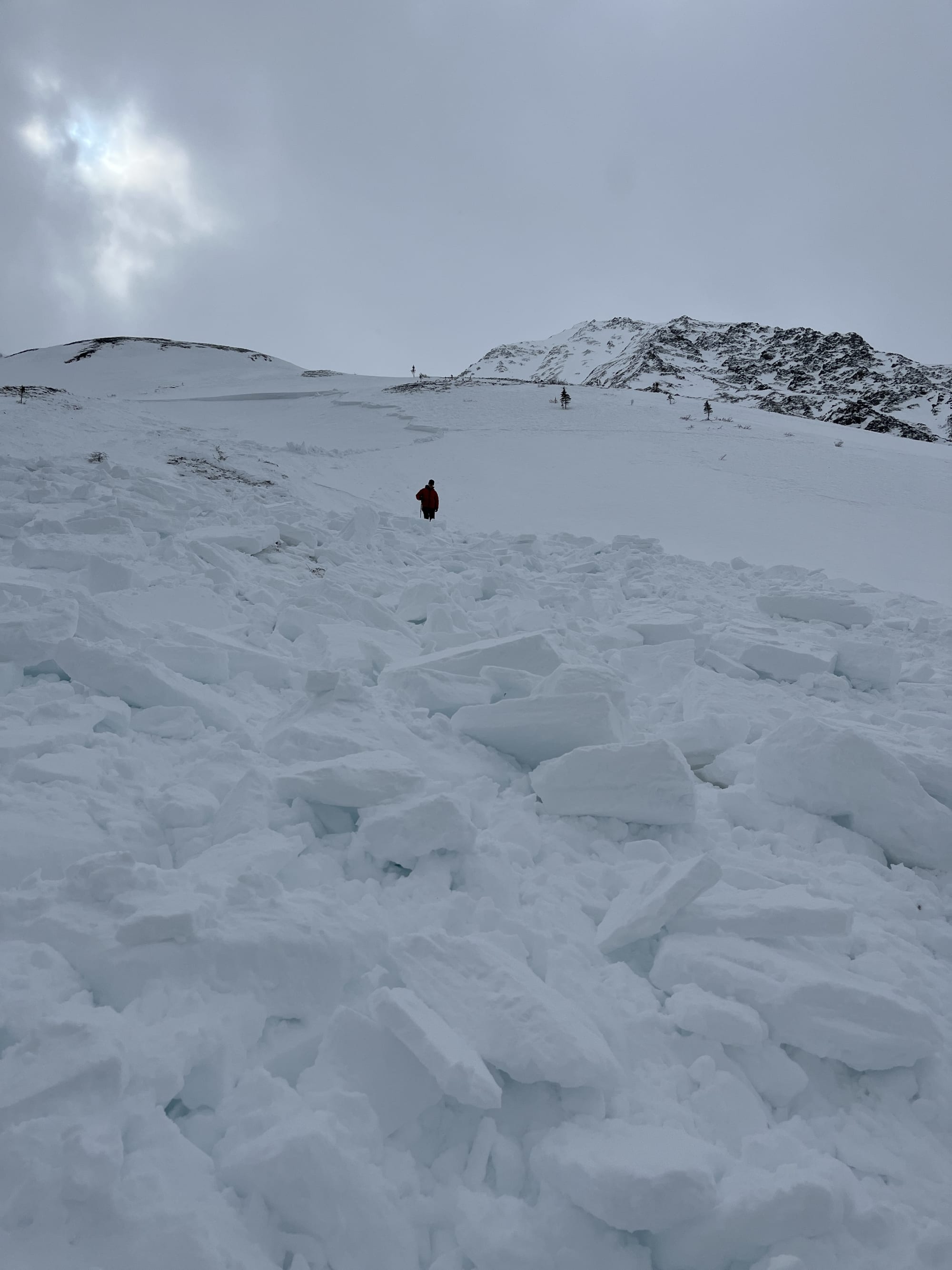
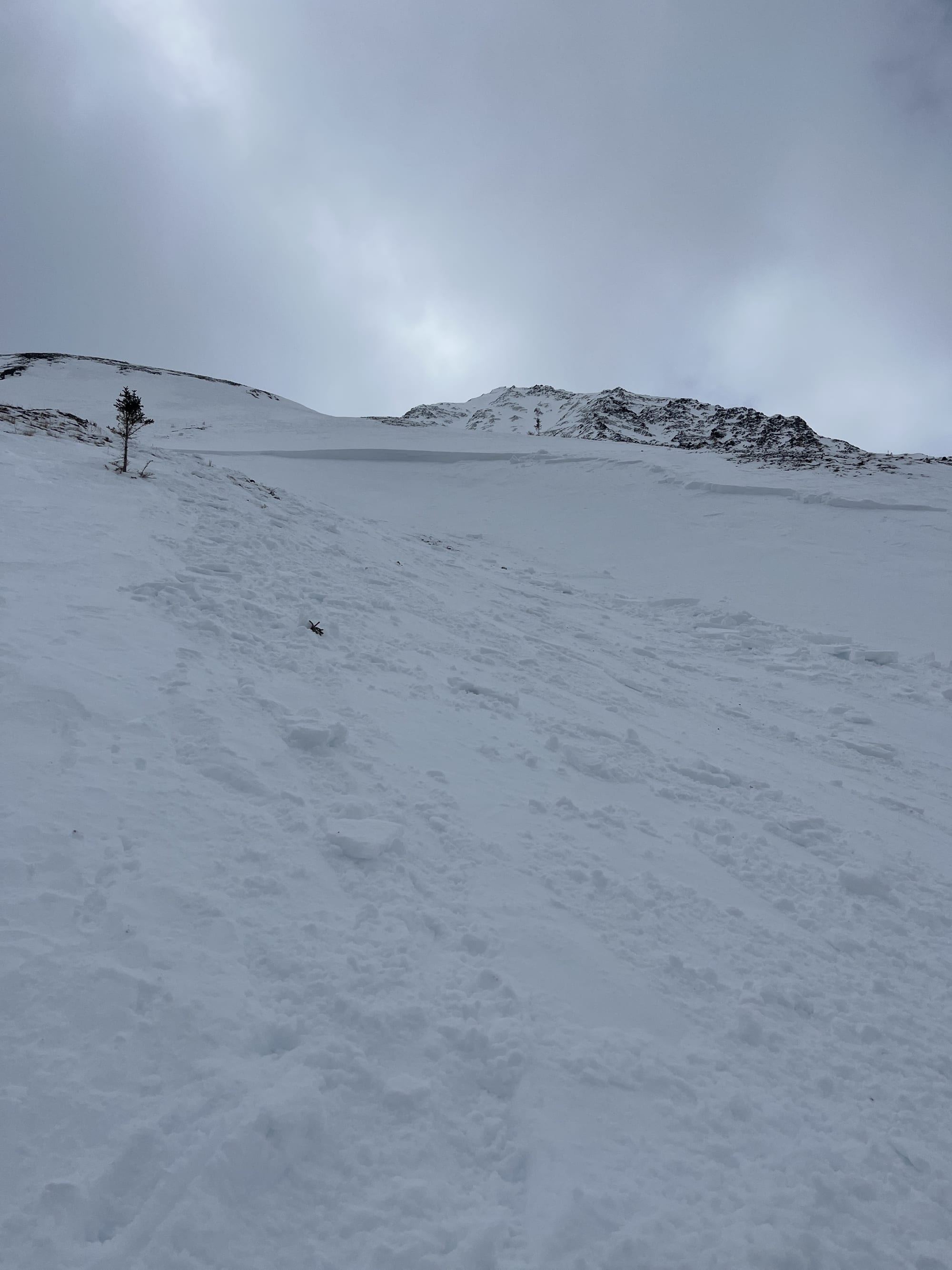
Size 2.5 slab avalanche with 2 people involved. Initiated 20 meters above in shallow area and propagated 50 meters wide. Crown height ranged from 20 to 120 cm. Ran on size 2 facets between crust and knife hard wind slab. Avalanche ran 250-300 meters. Slope angle 30-35 degrees.