- Date
- jeudi 28 mars 2024
For many mountain sports enthusiasts, spring is their favorite season. The mountains lure us in with a greater potential for good visibility and comfortable temperatures. If you are a skier, mountaineer, or sledder, you know some of the best alpine conditions are found late March into early May. For those into hiking or biking, the valley bottoms will start to melt out providing great low elevation adventures, but spring is not without its challenges.

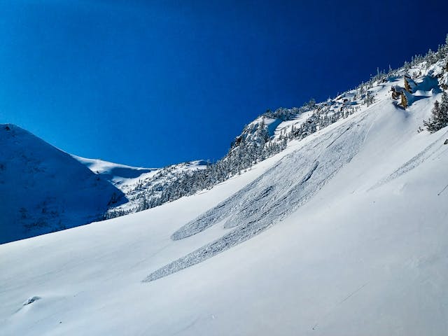
Loose wet avalanches, like this one in the North Rockies, are common in the spring.
The trick to having a good time in the mountains in spring is understanding the mixed bag of conditions waiting for you. It may be summer at valley bottom and winter on the summit—with a bit of everything in between. This time of year, a good avalanche forecast and knowledge of mountain weather is invaluable in your quest for adventure.

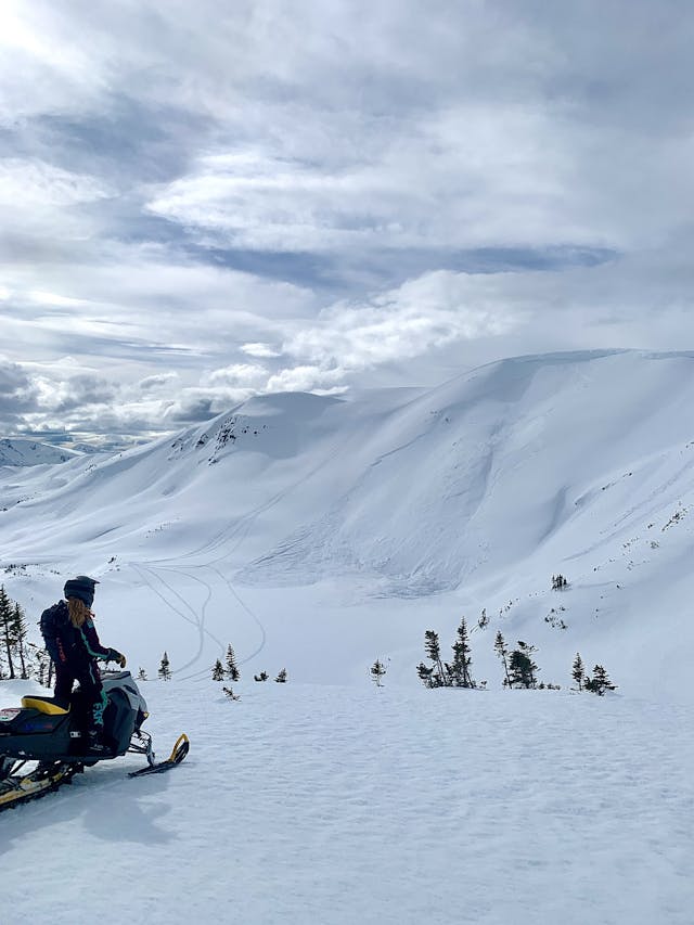
Signs of warming in the North Rockies.
Just like any other day, we start by looking at the avalanche forecast. We want to pay close attention to the elevation and aspect for each problem. Where on our proposed route will we be exposed to each problem?
- Wet loose avalanches are likely to be a problem on east aspects earlier in the day, and become a concern on south and west aspects as the day progresses. At lower elevations, daytime warming and the resulting rise in freezing level may increase the likelihood of this problem.
- During periods of rapid warming, large persistent or deep persistent slab avalanches may run all the way to valley bottoms. You may be hiking or biking on dry low elevation trails and unknowingly be exposed to avalanche danger.
- Wind or storm slab avalanche problems may still linger in high north facing alpine terrain.
- Cornices are largest in the spring and the chances of them falling increases with solar input and above freezing temperatures. These can be a hazard on their own, but they can also trigger large avalanches on the slopes below. Many recreationists have been killed or injured by simply being on a cornice and causing it to fall.

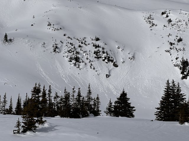
Cornice falls can cause large avalanches on the slopes beneath. This one was in the Northwest region this week.
Convective flurries are common in the spring. These can be problematic for two reasons. They can result in intense localized wind and precipitation, which can create or worsen a wind or storm slab avalanche problem. They can also surprise recreationists with limited visibility in alpine terrain.
There are also other hazards to consider beyond just avalanche problems. The daily rising and falling of freezing levels, commonly referred to as spring diurnal cycle, will usually form a strong surface crust. When this crust is present early in the morning, the likelihood of triggering avalanches is low. However, in steep terrain, this crust could pose a “slide for life hazard”. Self arresting on this firm smooth surface can be challenging.
There are several resources on our website to help in your spring planning beyond the avalanche forecast. The mountain weather forecast is a great starting point for your morning deep dive into expected conditions. Often it will describe unsettled air and the potential for convection, this can be challenging to pick out in local forecast products. Our weather station list can help you find a station near your objective that can help to verify freezing levels and other weather factors. And of course, the Mountain Information Network is full of valuable conditions reports.
Get the forecast, go further, get home at the end of the day. We will see you out there!
